MyTopo
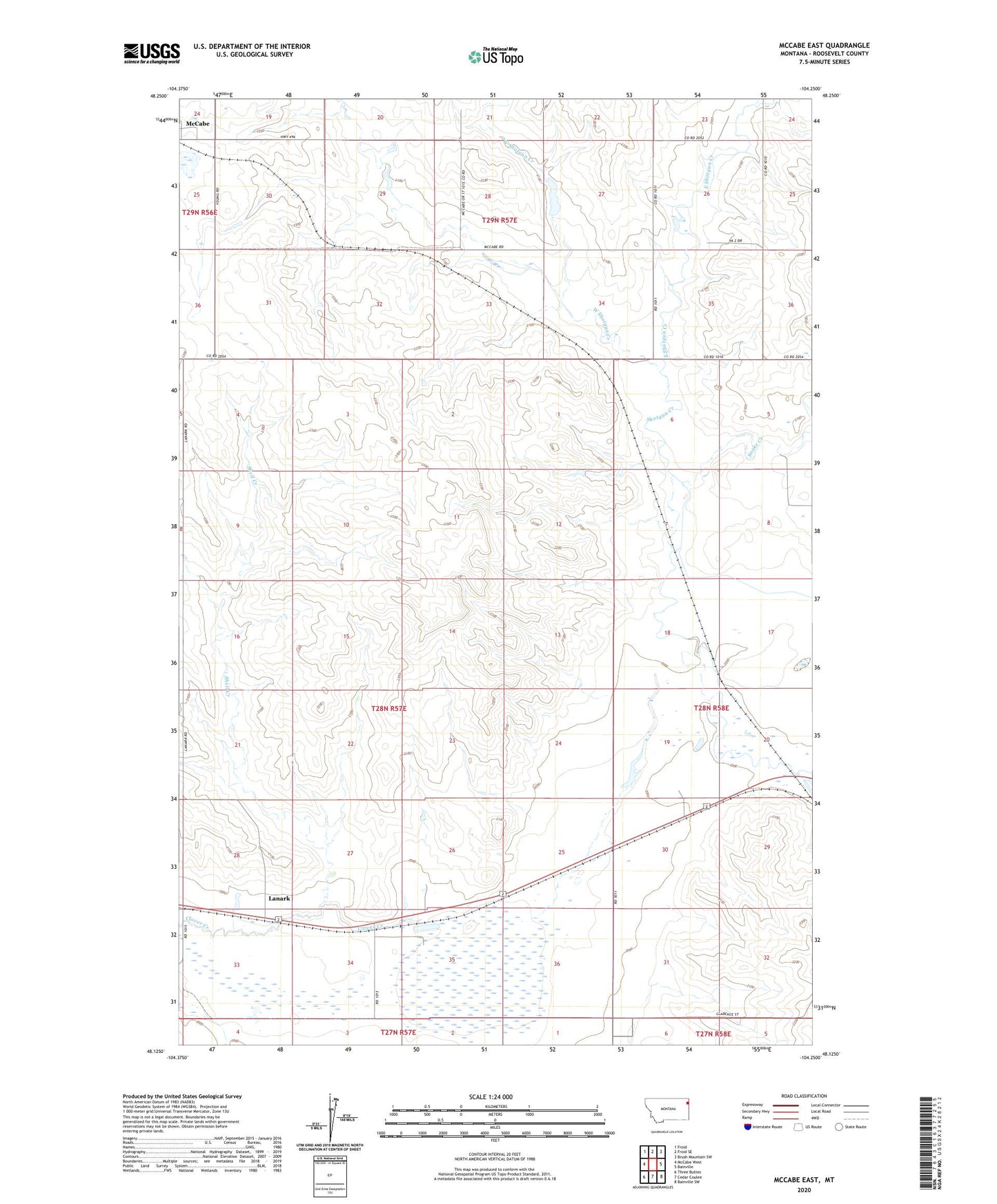
McCabe East Montana US Topo Map
Couldn't load pickup availability
2020 topographic map quadrangle McCabe East in the state of Montana. Scale: 1:24000. Based on the newly updated USGS 7.5' US Topo map series, this map is in the following counties: Roosevelt. The map contains contour data, water features, and other items you are used to seeing on USGS maps, but also has updated roads and other features. This is the next generation of topographic maps. Printed on high-quality waterproof paper with UV fade-resistant inks.
Quads adjacent to this one:
West: McCabe West
Northwest: Froid
North: Froid SE
Northeast: Brush Mountain SW
East: Bainville
Southeast: Bainville SW
South: Cedar Coulee
Southwest: Three Buttes
Contains the following named places: 27N57E02AA__01 Well, 27N57E04AB__01 Well, 27N58E06BB__01 Well, 28N41E36ADDB01 Well, 28N57E04AB__01 Well, 28N57E04BD__01 Well, 28N57E04DC__01 Well, 28N57E09CC__01 Well, 28N57E10BB__01 Well, 28N57E13DA__01 Well, 28N57E13DA__02 Well, 28N57E13DA__03 Well, 28N57E16CD__01 Well, 28N57E16CD__02 Well, 28N57E25BA__01 Well, 28N57E25CB__01 Well, 28N57E25CC__01 Well, 28N57E25CC__02 Well, 28N57E26CA__01 Well, 28N57E26CA__02 Well, 28N57E28CD__01 Well, 28N57E28DC__01 Well, 28N57E28DD__01 Well, 28N57E33AA__01 Well, 28N57E33AB__01 Well, 28N57E33CB__01 Well, 28N57E34DD__01 Well, 28N57E35AB__01 Well, 28N57E36AB__01 Well, 28N57E36DD__01 Well, 28N58E07BC__01 Well, 28N58E07BC__02 Well, 28N58E17CA__01 Well, 28N58E17CA__02 Well, 28N58E18DB__01 Well, 28N58E19DC__01 Well, 28N58E19DCDC01 Well, 28N58E19DD__01 Well, 28N58E31BB__01 Well, 28N58E31BB__02 Well, 28N58E31BB__03 Well, 28N58E31DB__01 Well, 29N57E30BCBB01 Well, 29N57E32BBBC01 Well, East Roosevelt Division, East Shotgun Creek, First Baptist Church, Hansen Dam, Harvey School, Lanark, Lanark Post Office, Lanark School, McCabe School, Shell Creek, Snake Creek, Ward Reservoir Dam, West Shotgun Creek