MyTopo
Bainville SW Montana US Topo Map
Couldn't load pickup availability
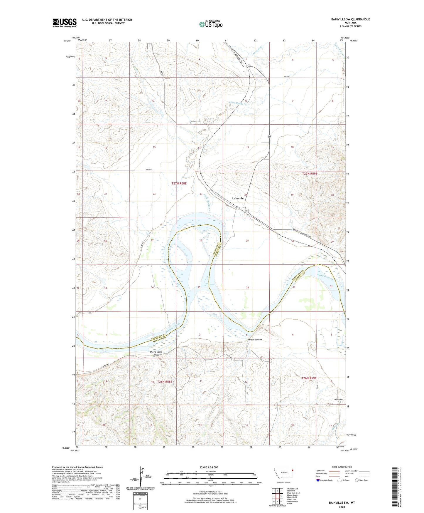
2024 topographic map quadrangle Bainville SW in the state of Montana. Scale: 1:24000. Based on the newly updated USGS 7.5' US Topo map series, this map is in the following counties: Roosevelt, Richland. The map contains contour data, water features, and other items you are used to seeing on USGS maps, but also has updated roads and other features. This is the next generation of topographic maps. Printed on high-quality waterproof paper with UV fade-resistant inks.
Quads adjacent to this one:
West: Cedar Coulee
Northwest: McCabe East
North: Bainville
Northeast: Red Bank Creek
East: Bainville SE
Southeast: Dore
South: Fairview NW
Southwest: Sioux Pass
This map covers the same area as the classic USGS quad with code o48104a2.
Contains the following named places: 26N58E01DA__01 Well, 26N58E02ACAC01 Well, 26N58E02CB__01 Well, 26N58E09DDBD01 Well, 26N58E15ADDC01 Well, 26N59E06BC__01 Well, 26N59E06DD__01 Well, 26N59E08CA__01 Well, 27N58E01BD__01 Well, 27N58E01CD__01 Well, 27N58E01CD__02 Well, 27N58E05DD__01 Well, 27N58E10BB__01 Well, 27N58E11CD__01 Well, 27N58E12DB__01 Well, 27N58E13DB__01 Well, 27N58E13DC__01 Well, 27N58E14CC__01 Well, 27N58E15BA__01 Well, 27N58E20DD__01 Well, 27N58E21AB__01 Well, 27N58E23AA__01 Well, 27N58E23BB__01 Well, 27N58E23BB__02 Well, 27N58E24AC__01 Well, 27N58E25BB__01 Well, 27N58E25CD__01 Well, 27N58E27AC__01 Well, 27N58E27AC__02 Well, 27N58E27BA__01 Well, 27N58E28AB__01 Well, 27N58E28CC__01 Well, 27N58E32AA__01 Well, 27N58E33DA__01 Well, 27N58E33DA__02 Well, 27N58E34BA__01 Well, 27N59E07DD__01 Well, 27N59E18BA__01 Well, 27N59E18CB__01 Well, 27N59E18CCBB01 Well, 27N59E29CA__01 Well, 27N59E30BA__01 Well, Belushi Dam, Benson Coulee, Burgess Reservoir Dam, Horse Tied Creek, Lakeside, Lakeside Church, Lakeside Post Office, Lakeside School, Little Muddy Creek, Nohly Cemetery, Sheep Camp Coulee, Shotgun Creek