MyTopo
Bainville Montana US Topo Map
Couldn't load pickup availability
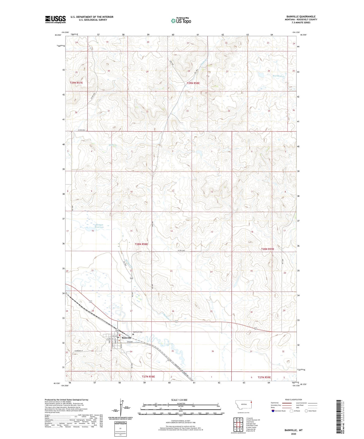
2024 topographic map quadrangle Bainville in the state of Montana. Scale: 1:24000. Based on the newly updated USGS 7.5' US Topo map series, this map is in the following counties: Roosevelt. The map contains contour data, water features, and other items you are used to seeing on USGS maps, but also has updated roads and other features. This is the next generation of topographic maps. Printed on high-quality waterproof paper with UV fade-resistant inks.
Quads adjacent to this one:
West: McCabe East
Northwest: Froid SE
North: Brush Mountain SW
Northeast: Bull Butte
East: Red Bank Creek
Southeast: Bainville SE
South: Bainville SW
Southwest: Cedar Coulee
This map covers the same area as the classic USGS quad with code o48104b2.
Contains the following named places: 27N58E02AA__01 Well, 27N58E02AA__02 Well, 27N58E03AA__01 Well, 27N58E03AB__01 Well, 27N58E03AB__02 Well, 28N58E04BA__01 Well, 28N58E04CC__01 Well, 28N58E04CC__02 Well, 28N58E05AD__01 Well, 28N58E05AD__02 Well, 28N58E05DD__01 Well, 28N58E13CADD01 Well, 28N58E14DD__01 Well, 28N58E15BB__01 Well, 28N58E15BD__01 Well, 28N58E15CA__01 Well, 28N58E20DA__01 Well, 28N58E21CD__01 Well, 28N58E22CD__01 Well, 28N58E22DC__01 Well, 28N58E24CA__01 Well, 28N58E24DC__01 Well, 28N58E25DB__01 Well, 28N58E26CD__01 Well, 28N58E26CD__02 Well, 28N58E26CD__03 Well, 28N58E26CDCD01 Well, 28N58E27ACDD01 Well, 28N58E28BC__01 Well, 28N58E29AA__01 Well, 28N58E33AA__01 Well, 28N58E34BA__01 Well, 28N58E34BB__01 Well, 28N58E34BB__02 Well, 28N58E34BD__01 Well, 28N58E34BD__02 Well, 28N58E35CA__01 Well, 28N59E17BA__01 Well, 28N59E17BA__02 Well, 28N59E17BA__03 Well, 28N59E17CC__01 Well, 28N59E19CC__01 Well, 28N59E29CBBB01 Well, 28N59E29CC__01 Well, 28N59E29CC__02 Well, 28N59E30AC__01 Well, 29N57E25DBDA01 Well, 29N58E28ABCD01 Well, 59212, Bainville, Bainville Cemetery, Bainville Methodist Church, Bainville Post Office, Bainville Public Library, Bainville Public School, Bainville Volunteer Fire Department, Crusch Pond Dam, Custom Built Feeds Elevator, Dunn School, Fairview Mill Elevator, Farmers Union Grain Terminal Association Elevator, Feisty Dam, First English Lutheran Church, Fort Union Historical Marker, Junction, Sacred Heart Catholic Church, Shotgun Reservoir, Town of Bainville, Wilde Dam