MyTopo
Froid SE Montana US Topo Map
Couldn't load pickup availability
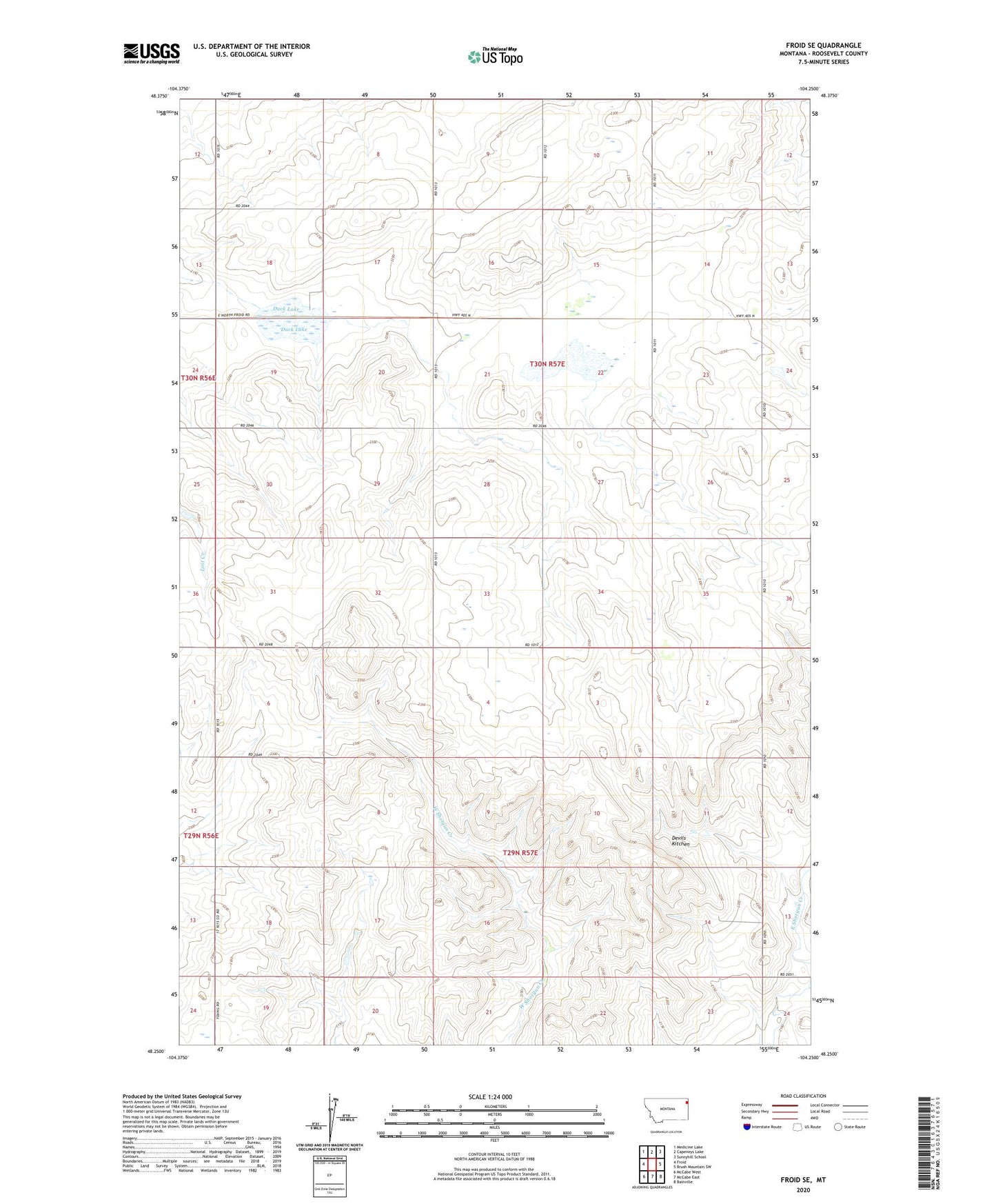
2024 topographic map quadrangle Froid SE in the state of Montana. Scale: 1:24000. Based on the newly updated USGS 7.5' US Topo map series, this map is in the following counties: Roosevelt. The map contains contour data, water features, and other items you are used to seeing on USGS maps, but also has updated roads and other features. This is the next generation of topographic maps. Printed on high-quality waterproof paper with UV fade-resistant inks.
Quads adjacent to this one:
West: Froid
Northwest: Medicine Lake
North: Capeneys Lake
Northeast: Sunnyhill School
East: Brush Mountain SW
Southeast: Bainville
South: McCabe East
Southwest: McCabe West
This map covers the same area as the classic USGS quad with code o48104c3.
Contains the following named places: 29N57E16CBCA01 Well, 30N57E23BCDC01 Well, 30N57E35BB__01 Well, Bergstrom School, Devils Kitchen, Duck Lake, Enterprise Post Office, Enterprise School, Grandview Church of the Brethren, National School, Valley School