MyTopo
Meyer Mountain Montana US Topo Map
Couldn't load pickup availability
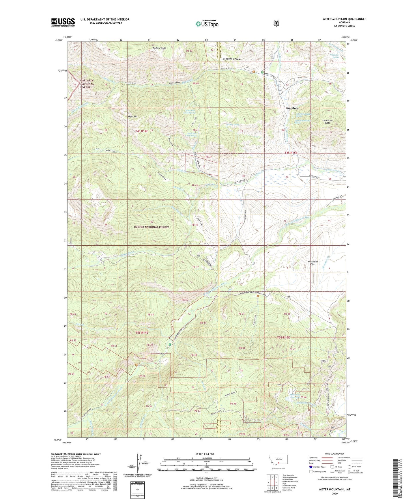
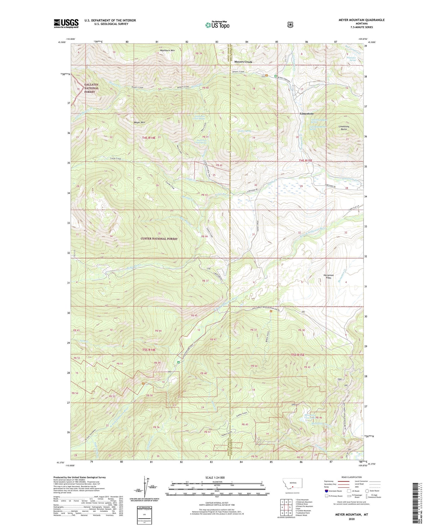
2020 topographic map quadrangle Meyer Mountain in the state of Montana. Scale: 1:24000. Based on the newly updated USGS 7.5' US Topo map series, this map is in the following counties: Sweet Grass, Stillwater. The map contains contour data, water features, and other items you are used to seeing on USGS maps, but also has updated roads and other features. This is the next generation of topographic maps. Printed on high-quality waterproof paper with UV fade-resistant inks.
Quads adjacent to this one:
West: Picket Pin Mountain
Northwest: Enos Mountain
North: Sliderock Mountain
Northeast: Wildcat Draw
East: Nye
Southeast: Mount Wood
South: Cathedral Point
Southwest: Tumble Mountain
Contains the following named places: 04S15E20ABBA01 Spring, 04S15E20ABCD01 Spring, 04S15E28AACC01 Spring, 04S15E28ACAD01 Spring, 04S15E28DBAB01 Spring, 04S15E29ACDA01 Well, 04S15E33ABDB01 Spring, 04S15E33BDBB01 Spring, 05S15E08CAAA01 Spring, 05S15E08DBBB01 Spring, 05S15E21AACA01 Well, Bear Pen Creek, Castle Creek, Cathedral Creek, Horseman Flats, Initial Creek, Iron Creek, Limestone, Limestone Butte, Limestone Post Office, Limestone School, Lodgepole Creek, Meyer Creek Work Center, Meyer Mountain, Meyers Creek, Meyers Creek Pass, Mouat Mine, Mount Mine, Mountain View, Mountain View Creek, Mountain View Lake, Moval Mill, North Pass Creek Spring, Pass Creek, Picket Pin Creek, Quaker Spring, Saderbalm Creek, South Fork Meyers Creek, South Pass Creek Spring, Swamp Creek, Verdigris Creek, Washburn Mountain, Whittaker Spring