MyTopo
Enos Mountain Montana US Topo Map
Couldn't load pickup availability
Also explore the Enos Mountain Forest Service Topo of this same quad for updated USFS data
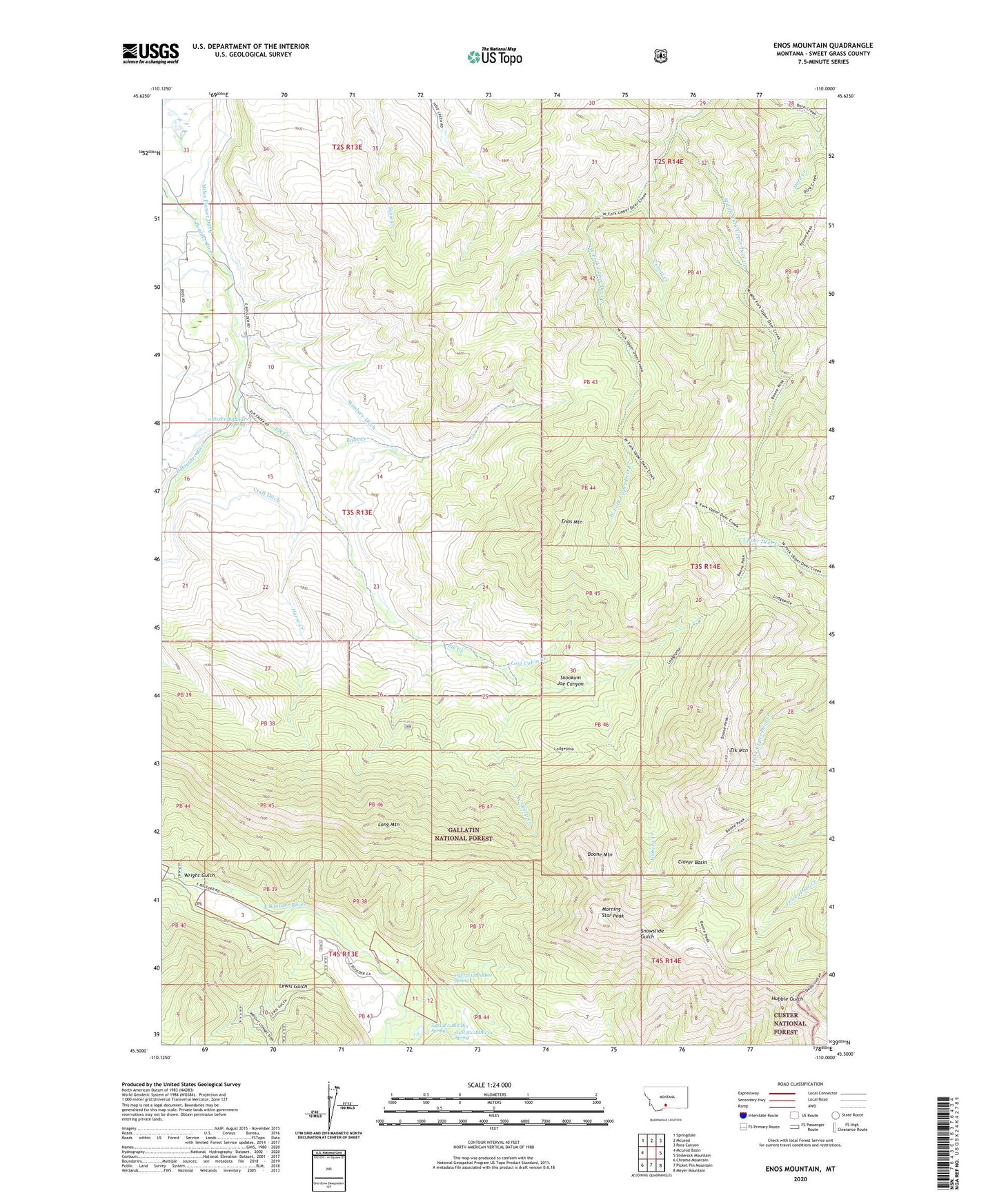
2024 topographic map quadrangle Enos Mountain in the state of Montana. Scale: 1:24000. Based on the newly updated USGS 7.5' US Topo map series, this map is in the following counties: Sweet Grass. The map contains contour data, water features, and other items you are used to seeing on USGS maps, but also has updated roads and other features. This is the next generation of topographic maps. Printed on high-quality waterproof paper with UV fade-resistant inks.
Quads adjacent to this one:
West: McLeod Basin
Northwest: Springdale
North: McLeod
Northeast: Ross Canyon
East: Sliderock Mountain
Southeast: Meyer Mountain
South: Picket Pin Mountain
Southwest: Chrome Mountain
Contains the following named places: 03S13E04AABD01 Well, 03S13E04ABAD01 Well, 03S13E14CCCA01 Well, 03S13E15BABA01 Spring, 04S12E25CBBD01 Well, 04S13E04ABAA01 Well, 04S13E12BABB01 Spring, 04S13E12BCBA01 Well, 04S13E12BCBA02 Well, 04S13E12BCBA03 Well, 04S13E12BCBA04 Well, 04S13E12BCBA05 Well, 04S13E12BCBA06 Well, 04S13E12BCBA07 Well, 04S13E12BCCD01 Spring, 04S13E12BDCC01 Spring, Boone Mountain, Clover Basin, Corral Creek, Craft Ditch, Dry Fork Creek, East Boulder School, East Sheep Creek, Elk Creek, Elk Mountain, Enos Creek, Enos Mountain, Farnsworth Homestead, Horse Creek, Lewis Gulch, Long Mountain, Lost Cabin Creek, McKinsey Homestead, Middle Fork Upper Deer Creek, Morning Star Peak, Seasongood Homestead, Skookum Joe Canyon, Stillwater Mining Company / Medcor East Boulder Mine, West Sheep Creek, Woolsey Ditch, Wright Gulch