MyTopo
Mission Lake West Montana US Topo Map
Couldn't load pickup availability
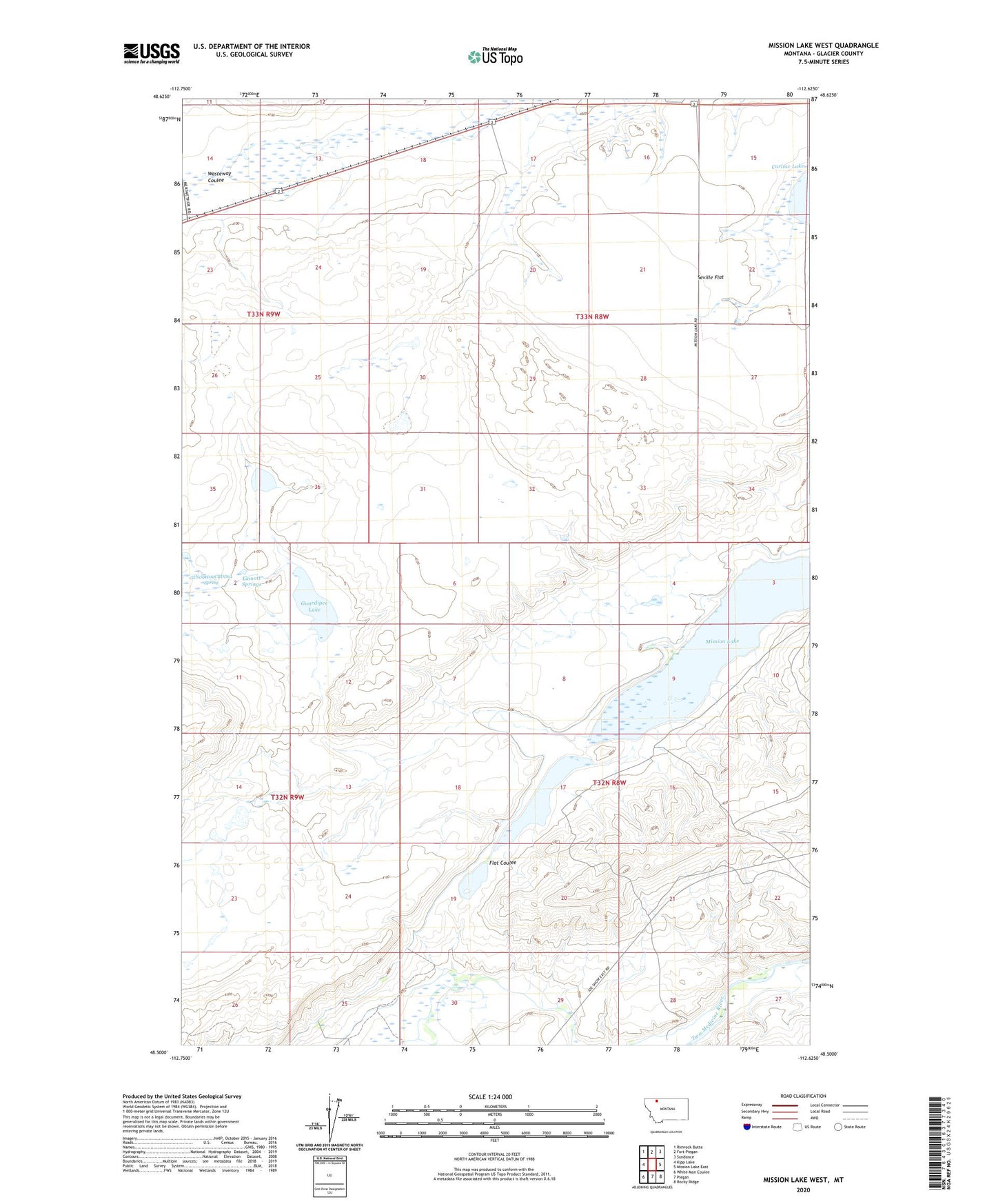
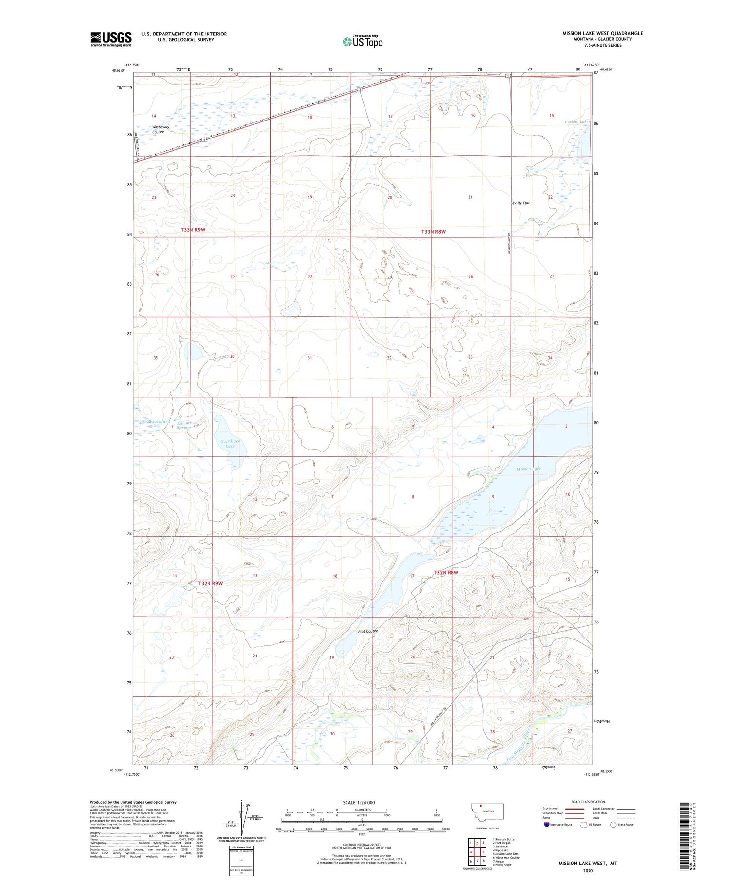
2020 topographic map quadrangle Mission Lake West in the state of Montana. Scale: 1:24000. Based on the newly updated USGS 7.5' US Topo map series, this map is in the following counties: Glacier. The map contains contour data, water features, and other items you are used to seeing on USGS maps, but also has updated roads and other features. This is the next generation of topographic maps. Printed on high-quality waterproof paper with UV fade-resistant inks.
Quads adjacent to this one:
West: Kipp Lake
Northwest: Rimrock Butte
North: Fort Piegan
Northeast: Sundance
East: Mission Lake East
Southeast: Rocky Ridge
South: Piegan
Southwest: White Man Coulee
Contains the following named places: 32N09W02CBDD01 Spring, Guardipee Lake, Lamott Springs, Mission Lake, Two Medicine Main Canal, Upper Mission Lake