
MyTopo
Monitor Peak Montana US Topo Map
Couldn't load pickup availability
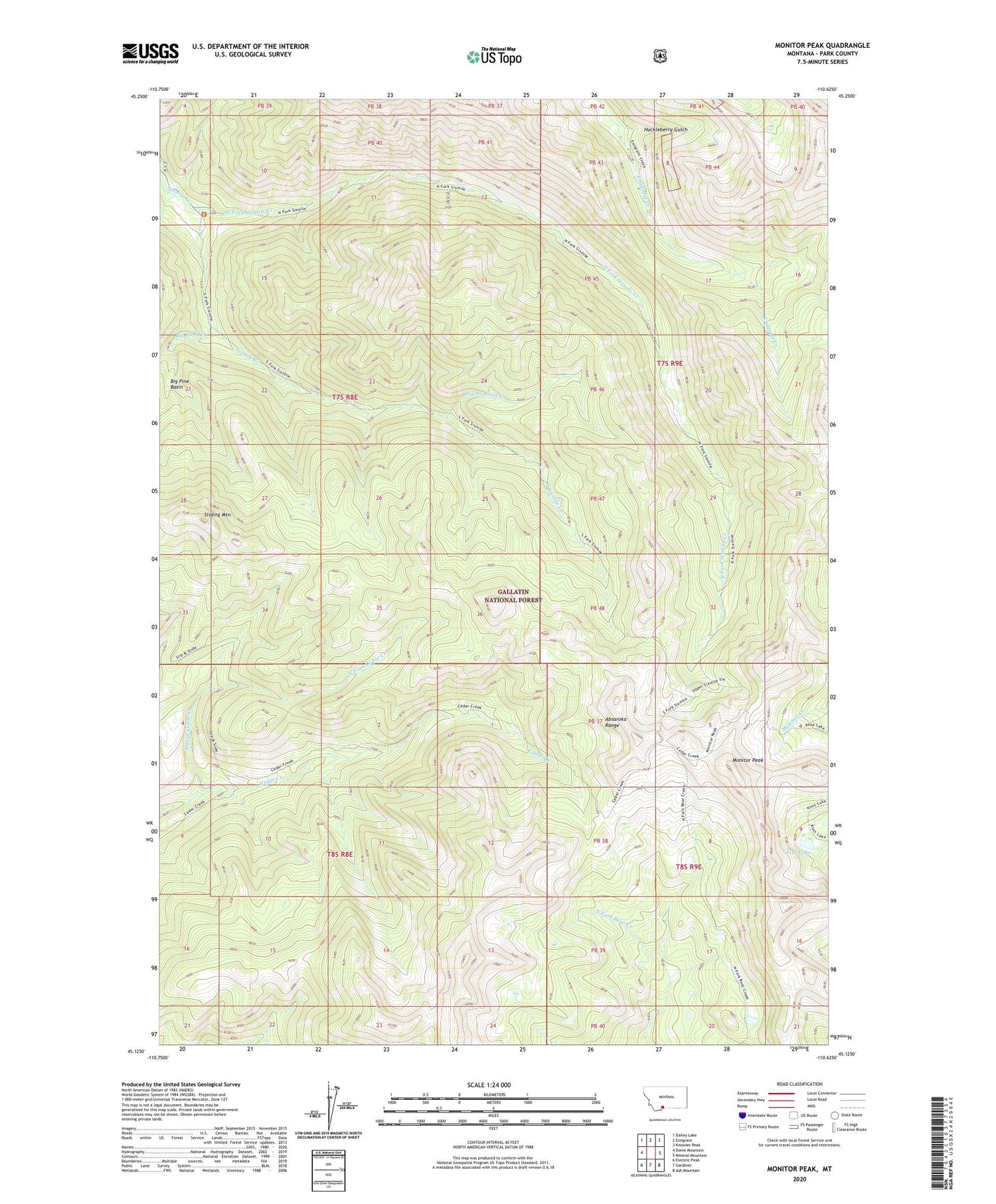
2020 topographic map quadrangle Monitor Peak in the state of Montana. Scale: 1:24000. Based on the newly updated USGS 7.5' US Topo map series, this map is in the following counties: Park. The map contains contour data, water features, and other items you are used to seeing on USGS maps, but also has updated roads and other features. This is the next generation of topographic maps. Printed on high-quality waterproof paper with UV fade-resistant inks.
Quads adjacent to this one:
West: Dome Mountain
Northwest: Dailey Lake
North: Emigrant
Northeast: Knowles Peak
East: Mineral Mountain
Southeast: Ash Mountain
South: Gardiner
Southwest: Electric Peak
Contains the following named places: B-47 Ridge, Big Pine Basin, Big Pine Creek, Fish Lake, Huckleberry Gulch, Mill Mine, Monitor Peak, North Fork Cedar Creek, North Fork Sixmile Creek, Placer Basin Creek, SE Section 6 Mine, Sliding Mountain, SW Section 5 Mine


