MyTopo
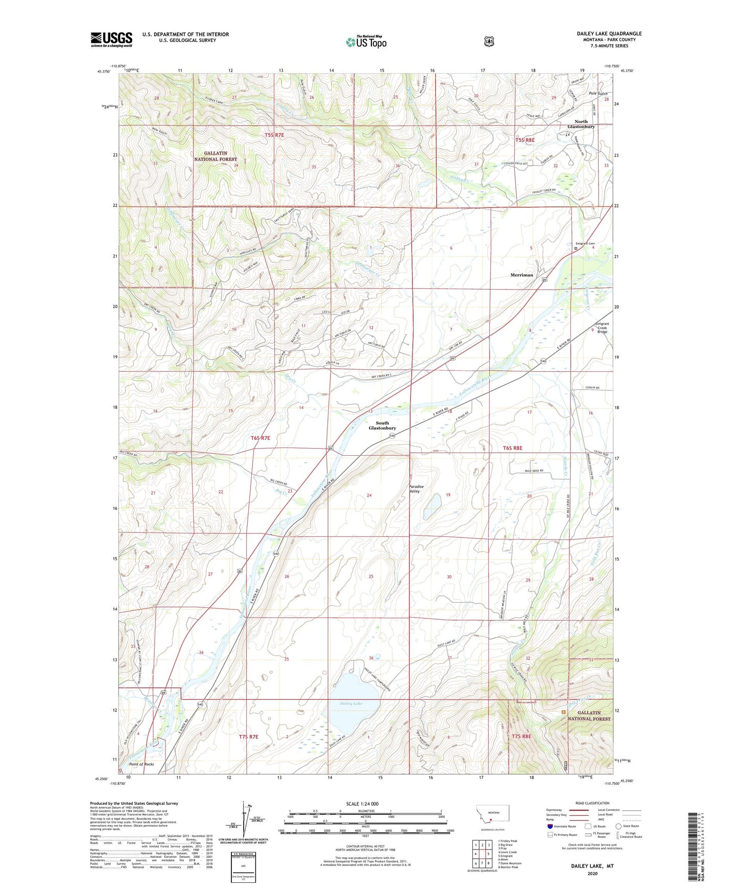
Dailey Lake Montana US Topo Map
Couldn't load pickup availability
Also explore the Dailey Lake Forest Service Topo of this same quad for updated USFS data
2024 topographic map quadrangle Dailey Lake in the state of Montana. Scale: 1:24000. Based on the newly updated USGS 7.5' US Topo map series, this map is in the following counties: Park. The map contains contour data, water features, and other items you are used to seeing on USGS maps, but also has updated roads and other features. This is the next generation of topographic maps. Printed on high-quality waterproof paper with UV fade-resistant inks.
Quads adjacent to this one:
West: Lewis Creek
Northwest: Fridley Peak
North: Big Draw
Northeast: Pray
East: Emigrant
Southeast: Monitor Peak
South: Dome Mountain
Southwest: Miner
This map covers the same area as the classic USGS quad with code o45110c7.
Contains the following named places: Absaroka-Beartooth Wilderness Historical Marker, Big Creek, Big Creek School, Bottlers Ranch, Dailey, Dailey Lake, Dailey Lake Campground, Dailey Lake Dam, Dailey Lake Fishing Access Site, Dailey School, Donahue Creek, Dry Creek, Emigrant Cemetery, Emigrant Creek, Emigrant Creek Bridge, Emigrant Gulch Historical Marker, Emigrant Post Office, Emigrant Rest Area, Fridley Creek, Glastonbury, Gold Prize Creek, Gold Run Creek, Goldmeyer Creek, Little Donahue Creek, Merriman, Miller Creek, Mountain View School, North Glastonbury, Point of Rocks, Point of Rocks Fishing Access Site, Pole Gulch, Sixmile Creek, South Glastonbury, South Glastonbury Census Designated Place, Tulley and Lowrys Spur, Yastremski Dam