MyTopo
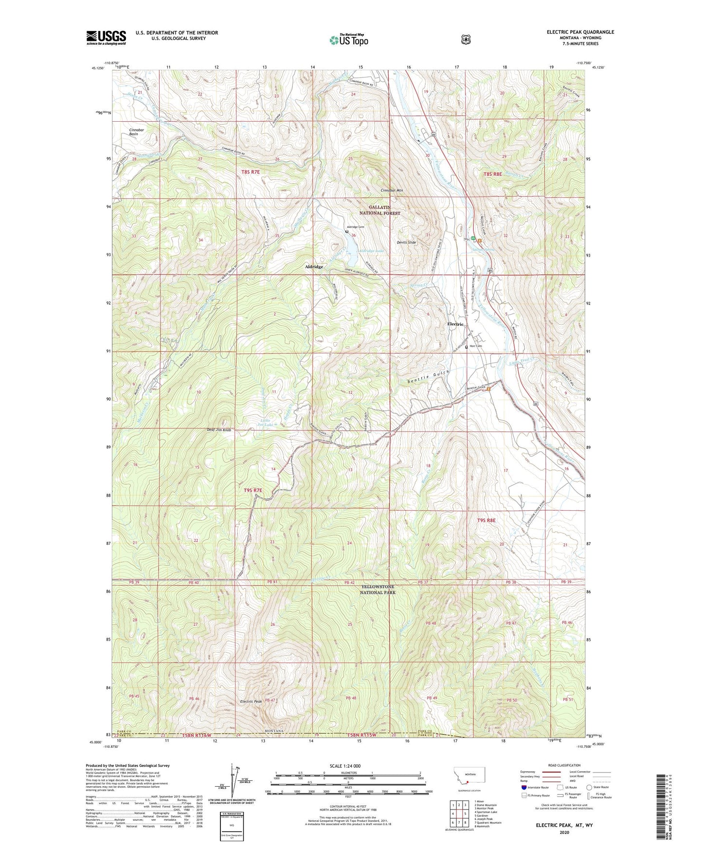
Electric Peak Montana US Topo Map
Couldn't load pickup availability
Also explore the Electric Peak Forest Service Topo of this same quad for updated USFS data
2024 topographic map quadrangle Electric Peak in the state of Montana. Scale: 1:24000. Based on the newly updated USGS 7.5' US Topo map series, this map is in the following counties: Park. The map contains contour data, water features, and other items you are used to seeing on USGS maps, but also has updated roads and other features. This is the next generation of topographic maps. Printed on high-quality waterproof paper with UV fade-resistant inks.
Quads adjacent to this one:
West: Sportsman Lake
Northwest: Miner
North: Dome Mountain
Northeast: Monitor Peak
East: Gardiner
Southeast: Mammoth
South: Quadrant Mountain
Southwest: Joseph Peak
Contains the following named places: 08S08E31DADA01 Well, 08S08E32CCAD01 Well, Aldridge, Aldridge Cemetery, Aldridge Creek, Aldridge Lake, Aldridge Post Office, Aldridge School, Bassett Creek, Beatie Gulch, Beattie Gulch, Cinnabar, Cinnabar Basin, Cinnabar Creek, Cinnabar Mountain, Cinnabar Post Office, Cinnabar School, Corwin School, Corwin Springs, Corwin Springs Fishing Access Site, Corwin Springs Post Office, Cottonwood Creek, Deaf Jim Creek, Deaf Jim Knob, Devils Slide, Dixon Creek, Electric, Electric Creek, Electric Peak, Electric Post Office, Electric School, Evensdale, Henderson Post Office, Herron, Hoppe Creek, Horr Cemetery, LaDuke Spring, LaDuke Spring Campground, LaDuke Springs, Little Joe Lake, Little Trail Creek, Newton Camp, Reese Creek, Spring Creek, Stephens Creek, Summit University, Yellowstone National Park Division