MyTopo
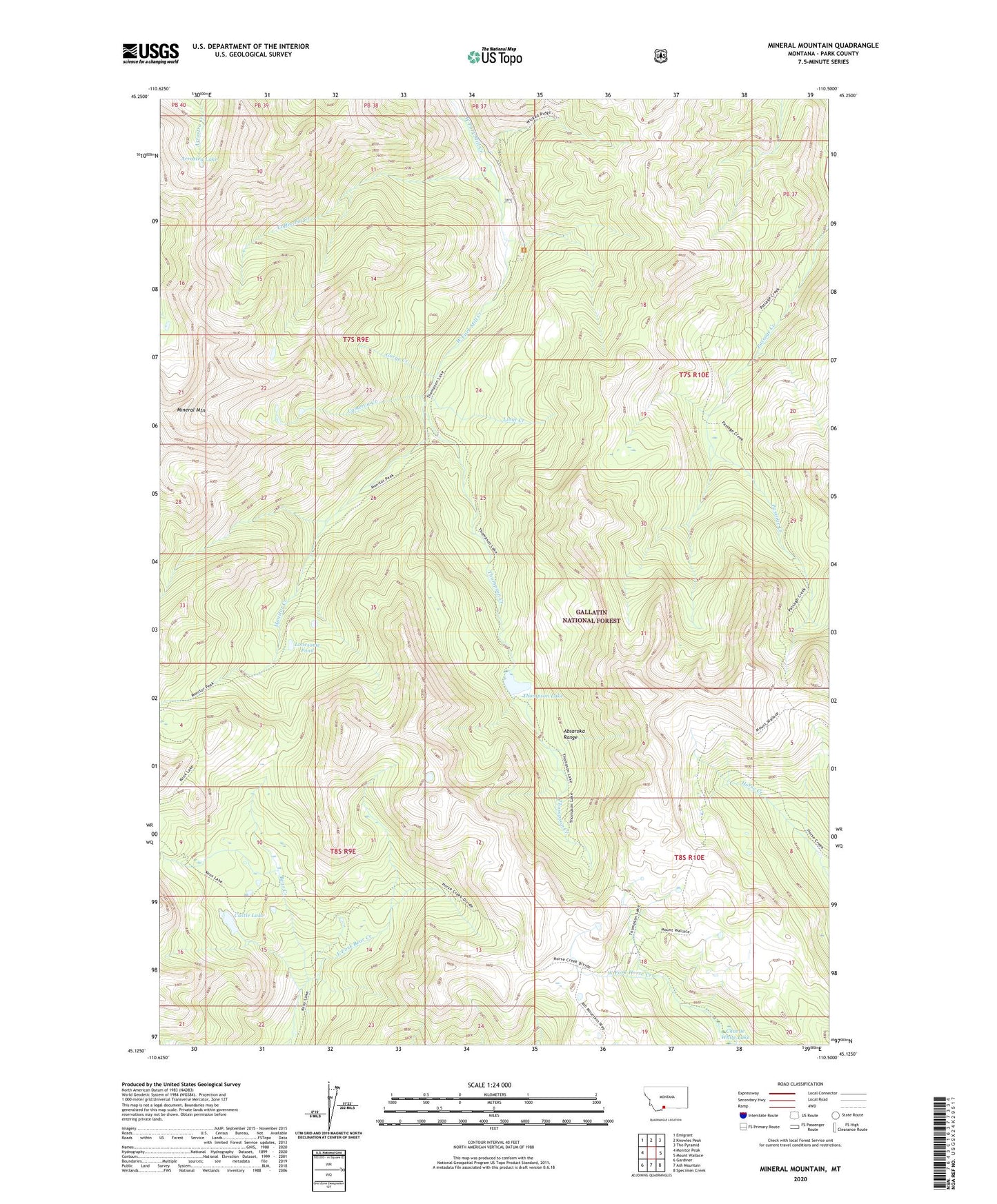
Mineral Mountain Montana US Topo Map
Couldn't load pickup availability
Also explore the Mineral Mountain Forest Service Topo of this same quad for updated USFS data
2024 topographic map quadrangle Mineral Mountain in the state of Montana. Scale: 1:24000. Based on the newly updated USGS 7.5' US Topo map series, this map is in the following counties: Park. The map contains contour data, water features, and other items you are used to seeing on USGS maps, but also has updated roads and other features. This is the next generation of topographic maps. Printed on high-quality waterproof paper with UV fade-resistant inks.
Quads adjacent to this one:
West: Monitor Peak
Northwest: Emigrant
North: Knowles Peak
Northeast: The Pyramid
East: Mount Wallace
Southeast: Specimen Creek
South: Ash Mountain
Southwest: Gardiner
This map covers the same area as the classic USGS quad with code o45110b5.
Contains the following named places: Arrastra Lake, Cameron Creek, Castle Lake, Coffee Pot Creek, East Fork Bear Creek, Gorge Creek, Limit Creek, Lonesome Pond, Mineral Mountain, Monitor Creek, Snowbank Trail, Thompson Creek, Thompson Lake