MyTopo
Moore Montana US Topo Map
Couldn't load pickup availability
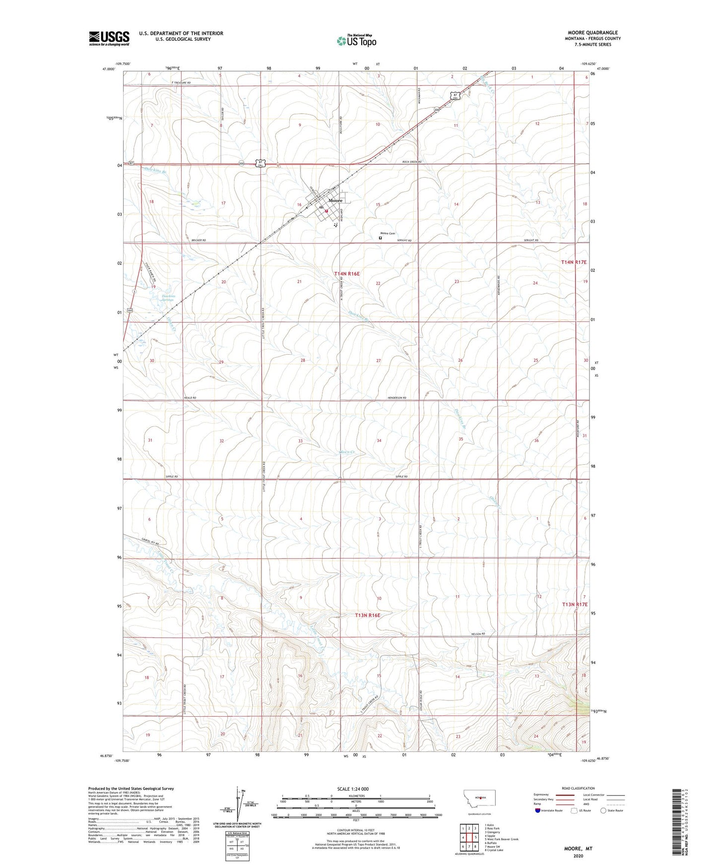
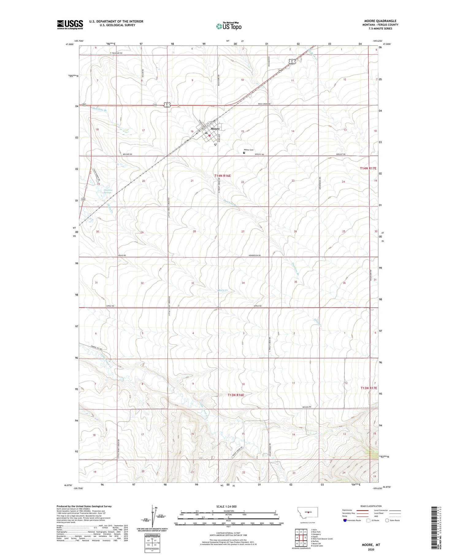
2020 topographic map quadrangle Moore in the state of Montana. Scale: 1:24000. Based on the newly updated USGS 7.5' US Topo map series, this map is in the following counties: Fergus. The map contains contour data, water features, and other items you are used to seeing on USGS maps, but also has updated roads and other features. This is the next generation of topographic maps. Printed on high-quality waterproof paper with UV fade-resistant inks.
Quads adjacent to this one:
West: Sipple
Northwest: Kolin
North: Ross Fork
Northeast: Glengarry
East: West Fork Beaver Creek
Southeast: Crystal Lake
South: Moore SW
Southwest: Buffalo
Contains the following named places: 13N16E01BA__01 Well, 13N16E02BC__01 Well, 13N16E04AA__01 Well, 13N16E07AA__01 Well, 13N16E08AA__01 Well, 13N16E11CB__01 Well, 13N16E11CB__02 Well, 13N16E12AB__01 Well, 13N16E12BD__01 Well, 13N16E13BCBC01 Well, 13N16E15AA__01 Well, 13N16E15CA__01 Well, 13N16E15DD__01 Well, 13N16E17AA__01 Well, 13N16E18DD__01 Well, 13N16E20AB__01 Well, 13N16E20BB__01 Well, 13N16E23BB__01 Well, 13N17E06BB__01 Well, 13N17E18BB__01 Well, 14N16E09DD__01 Well, 14N16E11DD__01 Well, 14N16E13DC__01 Well, 14N16E13DD__01 Well, 14N16E14DD__01 Well, 14N16E15AB__01 Well, 14N16E15AB__02 Well, 14N16E15BB__01 Well, 14N16E15BBCB01 Well, 14N16E15BBCB02 Well, 14N16E15CB__01 Well, 14N16E15DC__01 Well, 14N16E18ABBC01 Well, 14N16E19AC__01 Well, 14N16E19DB__01 Well, 14N16E21AD__01 Well, 14N16E22BA__01 Well, 14N16E23BA__01 Well, 14N16E24CB__01 Well, 14N16E25DC__01 Well, 14N16E26AA__01 Well, 14N16E27BB__01 Well, 14N16E28DA__01 Well, 14N16E28DA__02 Well, 14N16E32BB__01 Well, 14N16E32CD__01 Well, 14N16E32DA__01 Well, 14N16E33DA__01 Well, 14N16E34DD__01 Well, 14N16E35BA__01 Well, 14N16E35BA__02 Well, 14N16E36CC__01 Well, 59464, Community Methodist Church, Dawkins Springs, Eddies Corner, Eddies Corner Incorporated Campground, Meisser School, Moore, Moore Cemetery, Moore City Park, Moore Fire Department, Moore Hospital, Moore Memorial Library, Moore Post Office, Moore Public Schools, Moore Rural Fire District, Peavey Company Elevator, Pleasant View School, Rock Creek School, Saint Mathias Church, Seright, Seright School, Town of Moore, Trout Creek Post Office, Trout Creek School, Wright School