MyTopo
Sipple Montana US Topo Map
Couldn't load pickup availability
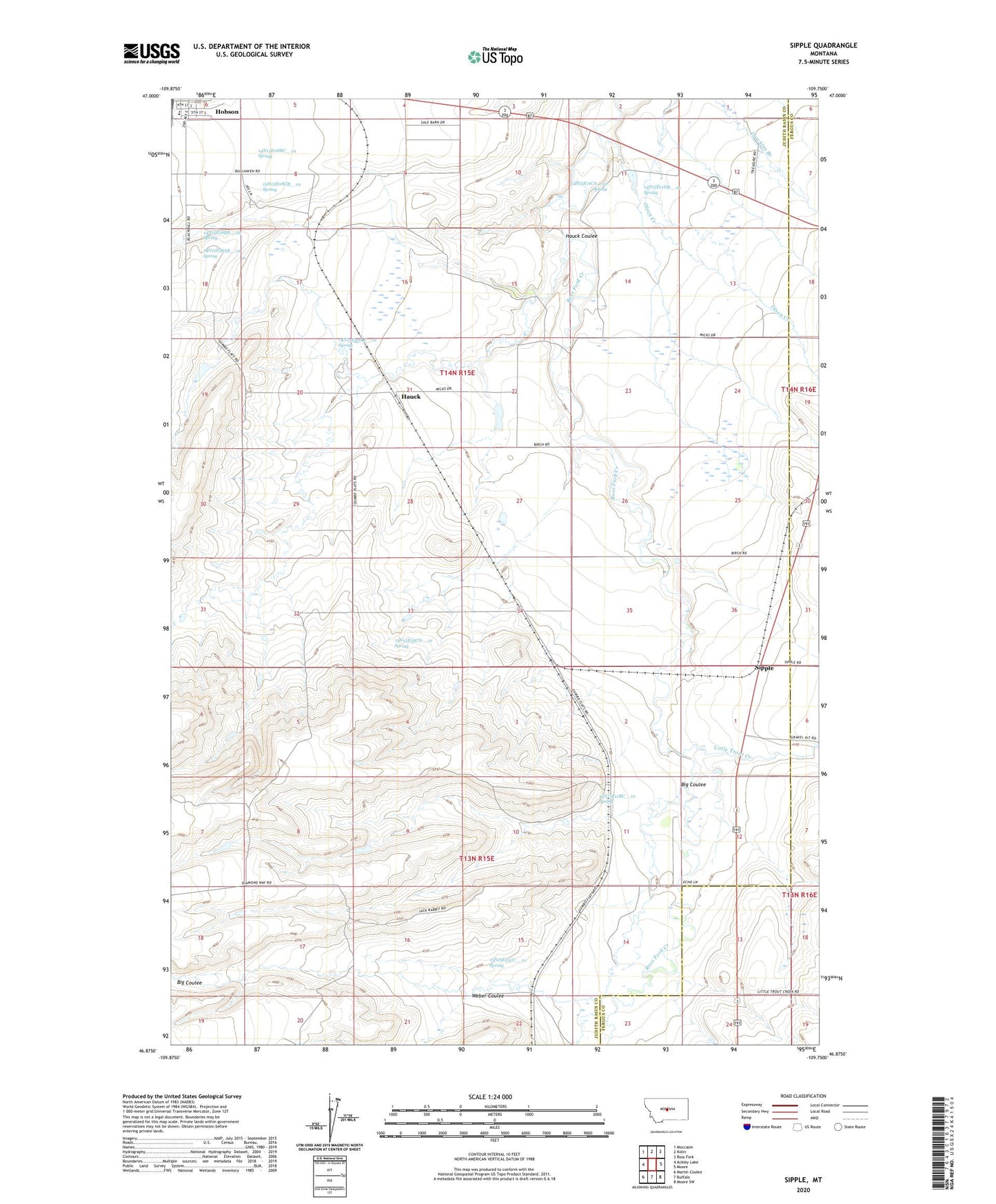
2024 topographic map quadrangle Sipple in the state of Montana. Scale: 1:24000. Based on the newly updated USGS 7.5' US Topo map series, this map is in the following counties: Judith Basin, Fergus. The map contains contour data, water features, and other items you are used to seeing on USGS maps, but also has updated roads and other features. This is the next generation of topographic maps. Printed on high-quality waterproof paper with UV fade-resistant inks.
Quads adjacent to this one:
West: Ackley Lake
Northwest: Moccasin
North: Kolin
Northeast: Ross Fork
East: Moore
Southeast: Moore SW
South: Buffalo
Southwest: Martin Coulee
This map covers the same area as the classic USGS quad with code o46109h7.
Contains the following named places: 13N15E01CA__01 Well, 13N15E01CA__02 Well, 13N15E01CA__03 Well, 13N15E01CADC01 Well, 13N15E11BC__01 Spring, 13N15E11BD__01 Well, 13N15E12BA__01 Well, 13N15E12DC__01 Well, 13N15E13DD__01 Well, 13N15E13DD__02 Well, 13N15E13DD__03 Well, 13N15E15CC__01 Spring, 13N15E17AA__01 Well, 13N15E17AA__02 Well, 13N15E17AA__03 Well, 13N15E17AAAA01 Well, 13N16E19BB__01 Well, 14N15E06DCBD01 Well, 14N15E07BA__01 Well, 14N15E07BA__02 Well, 14N15E07BA__03 Well, 14N15E07BA__04 Well, 14N15E07BA__05 Well, 14N15E08BC__01 Spring, 14N15E08CB__01 Spring, 14N15E11BDAC01 Well, 14N15E11CA__01 Spring, 14N15E11DB__01 Spring, 14N15E13CD__01 Well, 14N15E13CD__02 Well, 14N15E13CD__03 Well, 14N15E18AA__01 Well, 14N15E18AB__01 Spring, 14N15E18BB__02 Spring, 14N15E18DD__01 Well, 14N15E19CA__01 Well, 14N15E19CA__02 Well, 14N15E20AA__01 Spring, 14N15E20DC__01 Well, 14N15E23BA__01 Well, 14N15E23BA__02 Well, 14N15E24CA__01 Well, 14N15E26DD__01 Well, 14N15E28BA__01 Well, 14N15E28CB__01 Well, 14N15E29BB__01 Well, 14N15E30AA__01 Well, 14N15E32AA__01 Well, 14N15E33CD__01 Spring, 14N15E35AA__01 Well, 14N15E35AA__02 Well, 14N15E35AA__03 Well, Aries Dam, Big Coulee, City of Hobson, Dolomites Dam, Hauck, Hauck Coulee, Haven Reservoir Dam, Hobson Public Schools, Joan, Little Trout Creek, Mendon, Mendon Post Office, Miller Brothers Livestock Reservoir Dam, Rung Reservoir Dam, Sipple, Sipple School, Weber Coulee