MyTopo
Ross Fork Montana US Topo Map
Couldn't load pickup availability
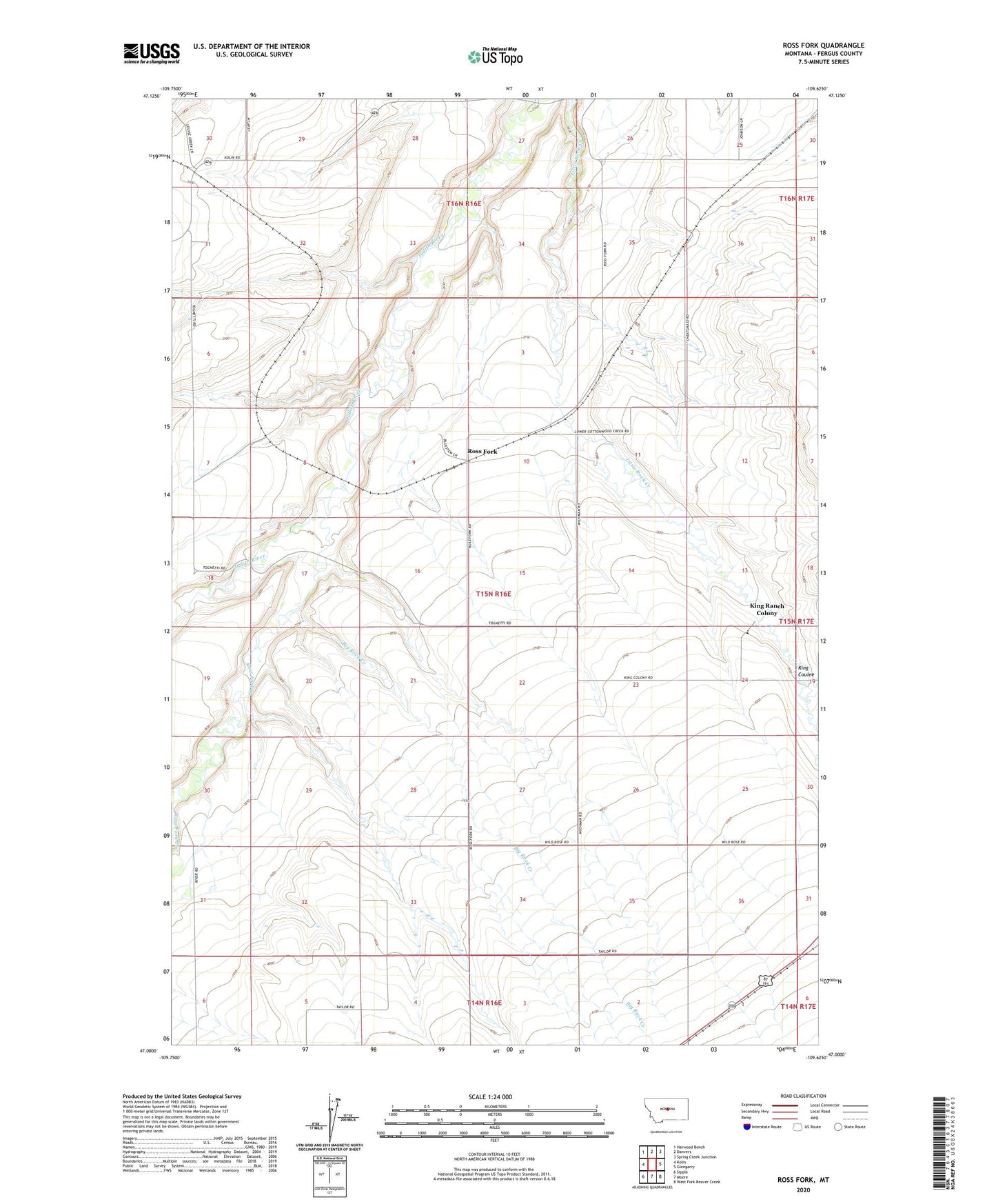
2024 topographic map quadrangle Ross Fork in the state of Montana. Scale: 1:24000. Based on the newly updated USGS 7.5' US Topo map series, this map is in the following counties: Fergus. The map contains contour data, water features, and other items you are used to seeing on USGS maps, but also has updated roads and other features. This is the next generation of topographic maps. Printed on high-quality waterproof paper with UV fade-resistant inks.
Quads adjacent to this one:
West: Kolin
Northwest: Harwood Bench
North: Danvers
Northeast: Spring Creek Junction
East: Glengarry
Southeast: West Fork Beaver Creek
South: Moore
Southwest: Sipple
This map covers the same area as the classic USGS quad with code o47109a6.
Contains the following named places: 14N16E02AADC01 Well, 15N16E09ADA_01 Well, 15N16E18BA__01 Well, 15N16E25CDDC01 Well, 15N16E34ADDC01 Well, 15N16E36DDD_01 Well, Big Rock Creek, Dudley Post Office, King Colony School, King Coulee, King Ranch Colony, King Ranch Colony Census Designated Place, Mennonite, Ross Fork, Ross Fork Creek, Ross Fork Post Office, State of Montana, Tognetti School, Wild Rose School