MyTopo
West Fork Beaver Creek Montana US Topo Map
Couldn't load pickup availability
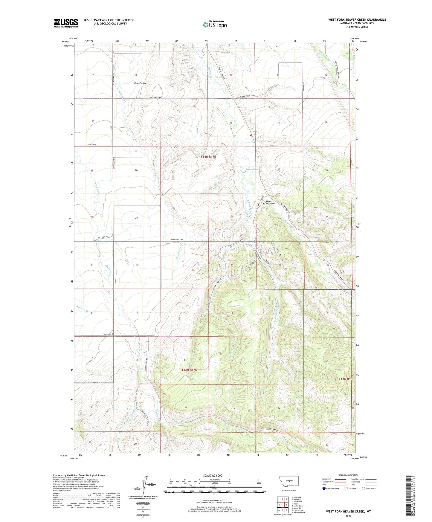
2024 topographic map quadrangle West Fork Beaver Creek in the state of Montana. Scale: 1:24000. Based on the newly updated USGS 7.5' US Topo map series, this map is in the following counties: Fergus. The map contains contour data, water features, and other items you are used to seeing on USGS maps, but also has updated roads and other features. This is the next generation of topographic maps. Printed on high-quality waterproof paper with UV fade-resistant inks.
Quads adjacent to this one:
West: Moore
Northwest: Ross Fork
North: Glengarry
Northeast: Lewistown
East: Castle Butte
Southeast: Jump Off Peak
South: Crystal Lake
Southwest: Moore SW
This map covers the same area as the classic USGS quad with code o46109h5.
Contains the following named places: 13N17E05CCDD01 Well, 13N17E05CDC_01 Well, 14N17E12ABAC01 Well, 14N17E15CDA_01 Well, 14N17E18DCD_01 Well, 14N17E18DCDC01 Well, 14N17E22AAAA01 Well, 14N17E34BDB_01 Well, Beacon Star Antique Airfield, Beaver Creek, Beaver Creek - Cottonwood Rural Fire District, Beaver Creek Cemetery, Beaver Creek School, Brassey Post Office, Long School, Middle Fork Beaver Creek, Middle Fork Beaver Creek School, Rock Creek School, Rockford, Rockford Post Office, West Fork Beaver Creek, West Fork Big Rock Creek