MyTopo
Moose Creek Montana US Topo Map
Couldn't load pickup availability
Also explore the Moose Creek Forest Service Topo of this same quad for updated USFS data
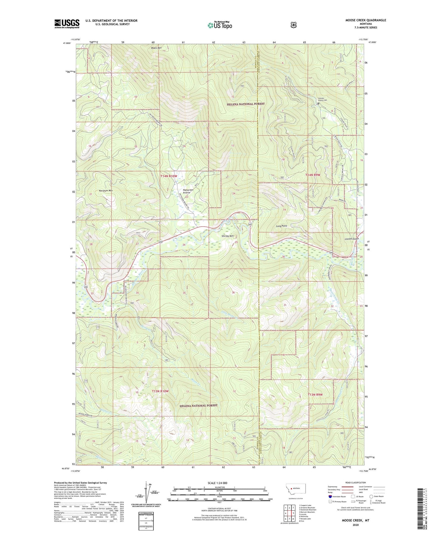
2024 topographic map quadrangle Moose Creek in the state of Montana. Scale: 1:24000. Based on the newly updated USGS 7.5' US Topo map series, this map is in the following counties: Powell, Lewis and Clark. The map contains contour data, water features, and other items you are used to seeing on USGS maps, but also has updated roads and other features. This is the next generation of topographic maps. Printed on high-quality waterproof paper with UV fade-resistant inks.
Quads adjacent to this one:
West: Marcum Mountain
Northwest: Coopers Lake
North: Arrastra Mountain
Northeast: Stonewall Mountain
East: Lincoln
Southeast: Finn
South: Nevada Lake
Southwest: Helmville
This map covers the same area as the classic USGS quad with code o46112h7.
Contains the following named places: 14N09W17ACBD01 Well, 14N09W17ACDD01 Well, Black Mountain, Blackfoot Canyon Campground, Blackfoot Canyon Fishing Access, Blackfoot Mine, Blackfoot Tailings, Kershaw Mountain, Lincoln Gulch, Lincoln Gulch Cemetery, Little Moose Creek, Long Point, Moose Creek, Patterson Prairie, Sauerkraut Creek, Shirley Mountain, Site of Old Lincoln, Willow Creek