MyTopo
Morgan Creek School Montana US Topo Map
Couldn't load pickup availability
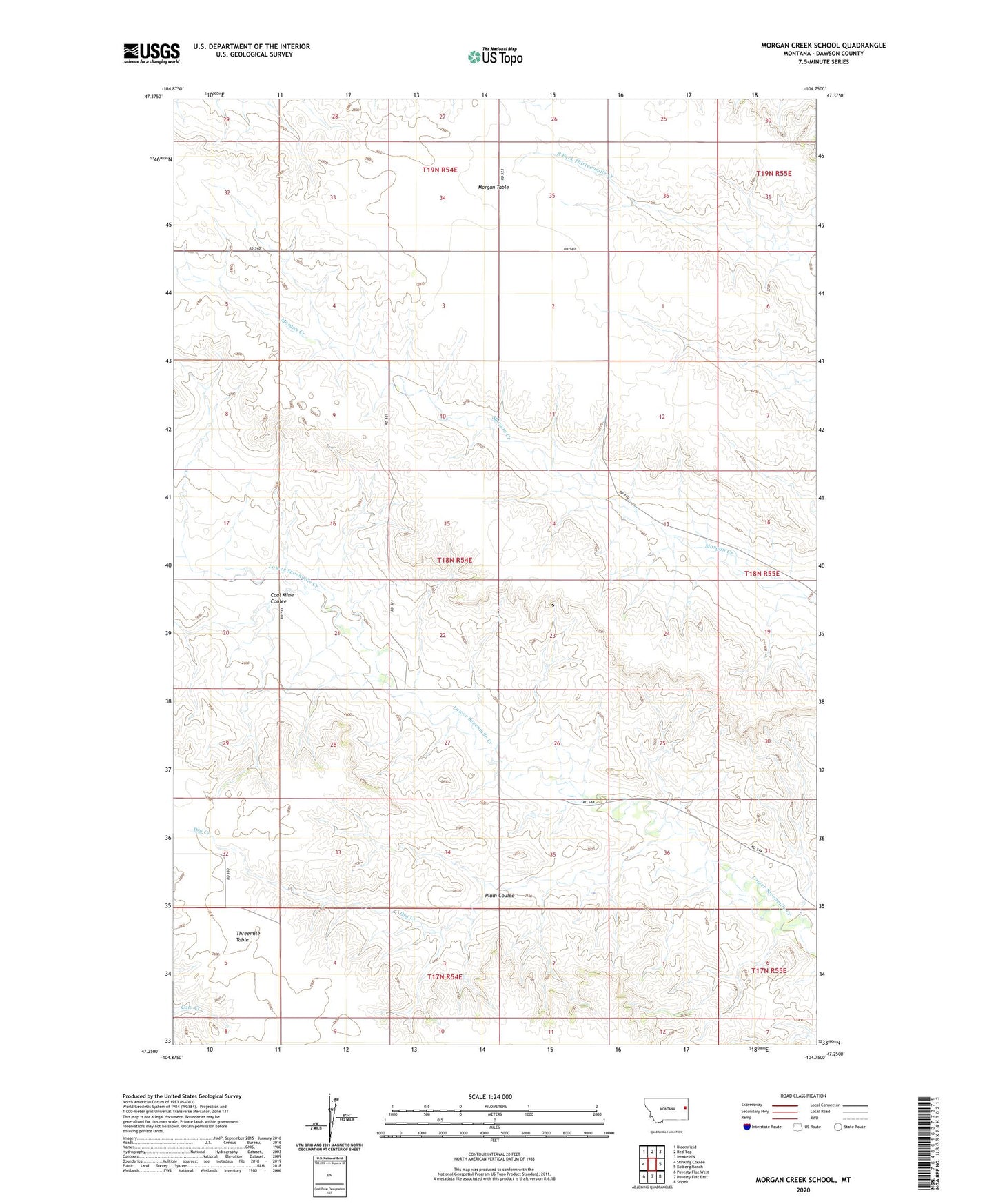
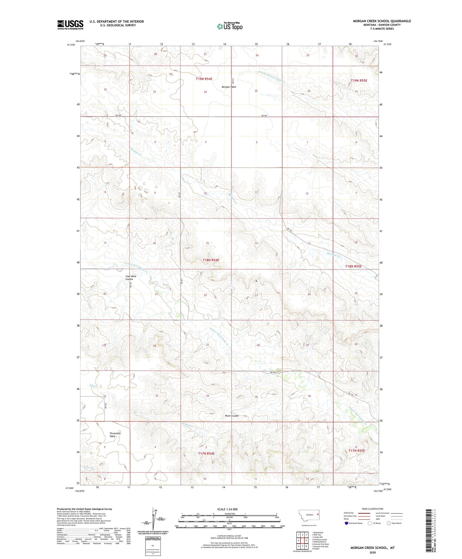
2020 topographic map quadrangle Morgan Creek School in the state of Montana. Scale: 1:24000. Based on the newly updated USGS 7.5' US Topo map series, this map is in the following counties: Dawson. The map contains contour data, water features, and other items you are used to seeing on USGS maps, but also has updated roads and other features. This is the next generation of topographic maps. Printed on high-quality waterproof paper with UV fade-resistant inks.
Quads adjacent to this one:
West: Stinking Coulee
Northwest: Bloomfield
North: Red Top
Northeast: Intake NW
East: Kolberg Ranch
Southeast: Stipek
South: Poverty Flat East
Southwest: Poverty Flat West
Contains the following named places: 17N54E09ABCC01 Well, 17N54E09ABCD01 Well, 18N54E08CABD01 Well, 18N54E10DBAC01 Well, 18N54E12CCCC01 Well, 18N54E21DADC01 Well, 18N54E25BDDD01 Well, 18N54E32BDCD01 Well, Coal Mine Coulee, Dry Creek, Lower Sevenmile School, Morgan Creek School, Morgan Table, Plum Coulee, Threemile School, Threemile Table