MyTopo
Red Top Montana US Topo Map
Couldn't load pickup availability
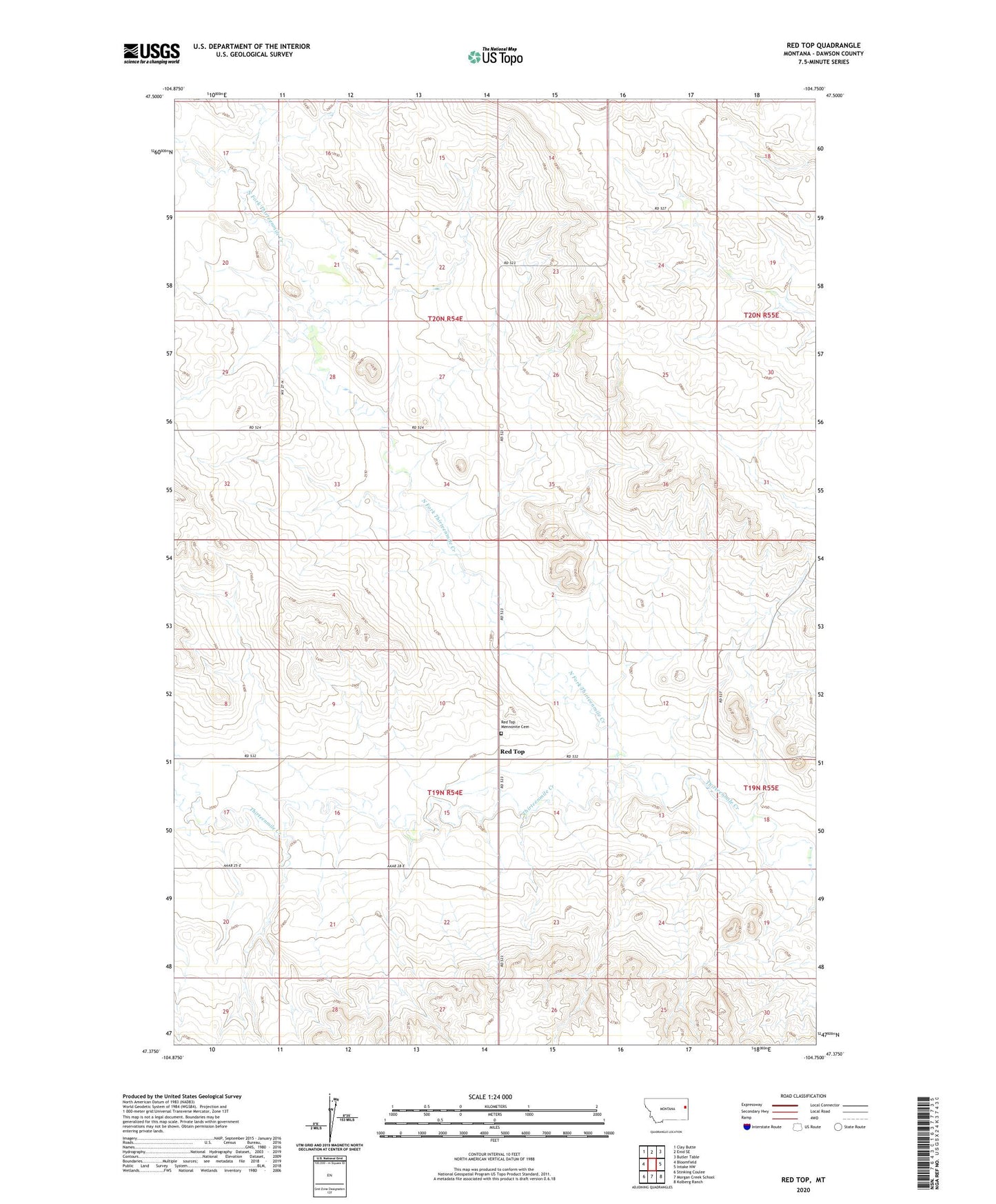
2024 topographic map quadrangle Red Top in the state of Montana. Scale: 1:24000. Based on the newly updated USGS 7.5' US Topo map series, this map is in the following counties: Dawson. The map contains contour data, water features, and other items you are used to seeing on USGS maps, but also has updated roads and other features. This is the next generation of topographic maps. Printed on high-quality waterproof paper with UV fade-resistant inks.
Quads adjacent to this one:
West: Bloomfield
Northwest: Clay Butte
North: Enid SE
Northeast: Butler Table
East: Intake NW
Southeast: Kolberg Ranch
South: Morgan Creek School
Southwest: Stinking Coulee
This map covers the same area as the classic USGS quad with code o47104d7.
Contains the following named places: 19N54E08CDCD01 Well, 19N54E10ADAA01 Well, 19N54E22BCDD01 Well, 19N54E25CBBC01 Well, 19N55E06BAAD01 Well, 19N55E18BDDD01 Well, 20N54E28DCDA01 Well, 20N55E19DBCD01 Well, 20N55E30DABD01 Well, 59315, Center Fork Thirteen Mile Creek, Muldoon School, North Fork Thirteenmile Creek, Red Top, Red Top Mennonite Cemetery, Red Top Mennonite Church, Red Top School