MyTopo
Kolberg Ranch Montana US Topo Map
Couldn't load pickup availability
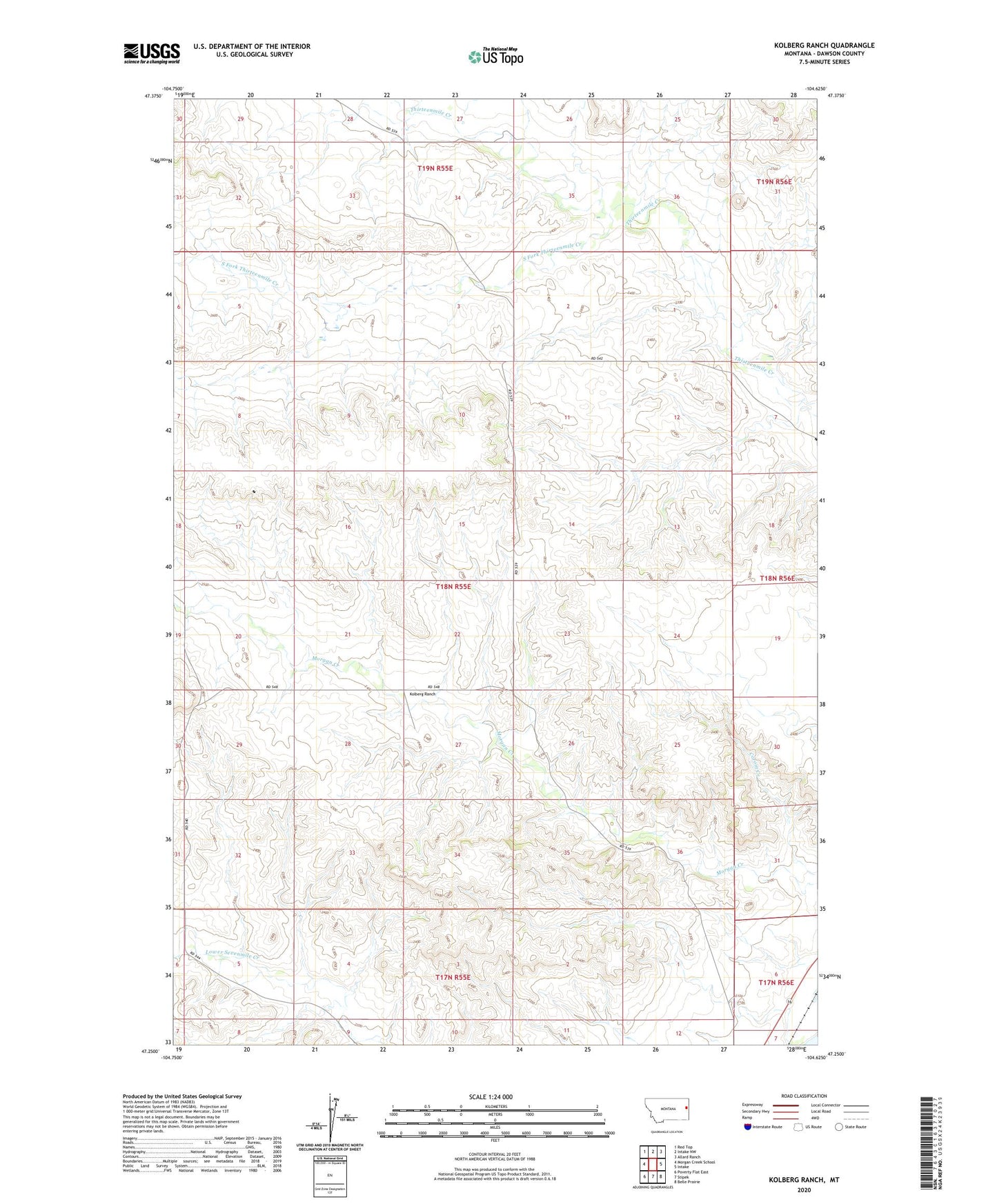
2024 topographic map quadrangle Kolberg Ranch in the state of Montana. Scale: 1:24000. Based on the newly updated USGS 7.5' US Topo map series, this map is in the following counties: Dawson. The map contains contour data, water features, and other items you are used to seeing on USGS maps, but also has updated roads and other features. This is the next generation of topographic maps. Printed on high-quality waterproof paper with UV fade-resistant inks.
Quads adjacent to this one:
West: Morgan Creek School
Northwest: Red Top
North: Intake NW
Northeast: Allard Ranch
East: Intake
Southeast: Belle Prairie
South: Stipek
Southwest: Poverty Flat East
This map covers the same area as the classic USGS quad with code o47104c6.
Contains the following named places: 17N55E06ADDA01 Well, 18N55E02BCBB01 Well, 18N55E09BDAD01 Well, 18N55E14ADBC01 Well, 18N55E23BDCD01 Well, 18N55E27BBBA01 Well, 18N55E28AADC01 Well, 18N55E29AACD01 Well, 18N56E06ABDD01 Well, 19N55E26CCCA01 Well, Kolberg Ranch, South Fork Thirteenmile Creek