MyTopo
Bloomfield Montana US Topo Map
Couldn't load pickup availability
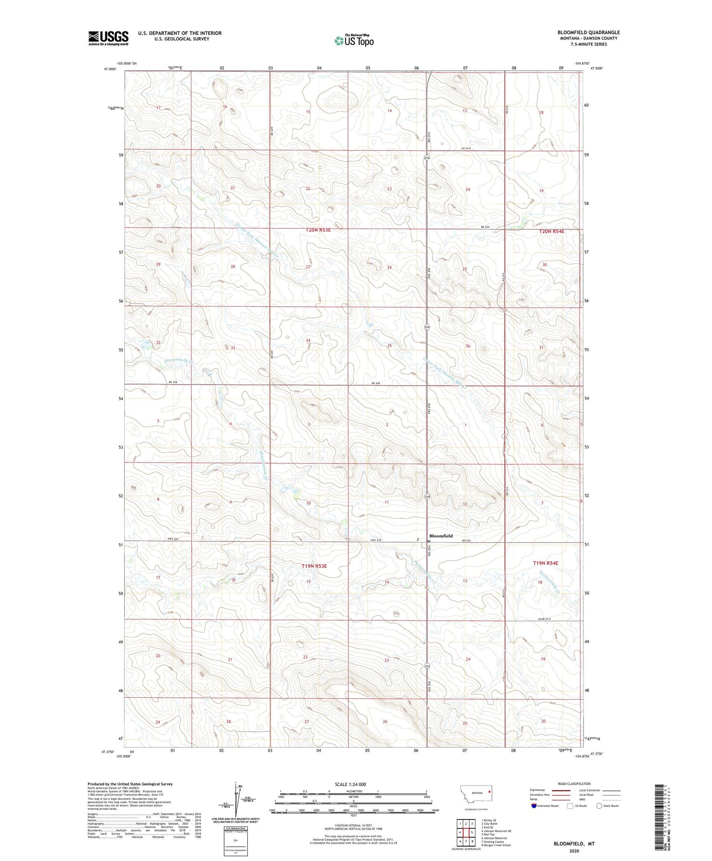
2024 topographic map quadrangle Bloomfield in the state of Montana. Scale: 1:24000. Based on the newly updated USGS 7.5' US Topo map series, this map is in the following counties: Dawson. The map contains contour data, water features, and other items you are used to seeing on USGS maps, but also has updated roads and other features. This is the next generation of topographic maps. Printed on high-quality waterproof paper with UV fade-resistant inks.
Quads adjacent to this one:
West: Johnson Reservoir NE
Northwest: Richey SE
North: Clay Butte
Northeast: Enid SE
East: Red Top
Southeast: Morgan Creek School
South: Stinking Coulee
Southwest: Johnson Reservoir
This map covers the same area as the classic USGS quad with code o47104d8.
Contains the following named places: 19N53E12DCBB01 Well, 19N53E24BBBB01 Well, 19N53E24CCDC01 Well, 19N54E30BABC01 Well, 20N53E14BBCC01 Well, 20N53E16AADB01 Well, 20N53E22BCCC01 Well, 20N53E26AAAD01 Well, 20N53E26BCCB01 Well, 20N53E32DBBD01 Well, 20N54E18BCCA01 Well, 20N54E19DC__01 Well, Bloomfield, Bloomfield Census Designated Place, Bloomfield Christian Missionary Alliance Church, Bloomfield Post Office, Bloomfield School, Everett Hill School, Oh No Dam, Pleasant Valley School, Raise Number 1 Dam, Steffen School