MyTopo
Mount Cleveland Montana US Topo Map
Couldn't load pickup availability
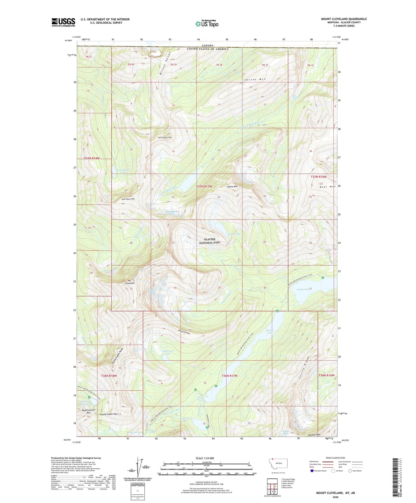
2024 topographic map quadrangle Mount Cleveland in the state of Montana. Scale: 1:24000. Based on the newly updated USGS 7.5' US Topo map series, this map is in the following counties: Glacier. The map contains contour data, water features, and other items you are used to seeing on USGS maps, but also has updated roads and other features. This is the next generation of topographic maps. Printed on high-quality waterproof paper with UV fade-resistant inks.
Quads adjacent to this one:
West: Porcupine Ridge
East: Gable Mountain
Southeast: Many Glacier
South: Ahern Pass
Southwest: Mount Geduhn
This map covers the same area as the classic USGS quad with code o48113h7.
Contains the following named places: Atsina Lake, Bear Mountain, Cosley Lake, Cosley Ridge, Glenns Lake, Goat Haunt Lake, Goat Haunt Mountain, Kaina Creek, Kaina Lake, Kaina Mountain, Lewis Range, Miche Wabun Falls, Miche Wabun Glacier, Miche Wabun Lake, Miche Wabun Peak, Mokowanis Cascade, Mokowanis Lake, Mokowanis Shelter Cabin, Mount Cleveland, Pyramid Creek, Sarcee Mountain, Stoney Indian Lake, Stoney Indian Pass, Stoney Indian Pass Trail, Stoney Indian Peaks, Wahcheechee Mountain, White Quiver Falls, Whitecrow Creek, Whitecrow Glacier, Whitecrow Lake, Whitecrow Mountain, Wilson Range