MyTopo
Mount Geduhn Montana US Topo Map
Couldn't load pickup availability
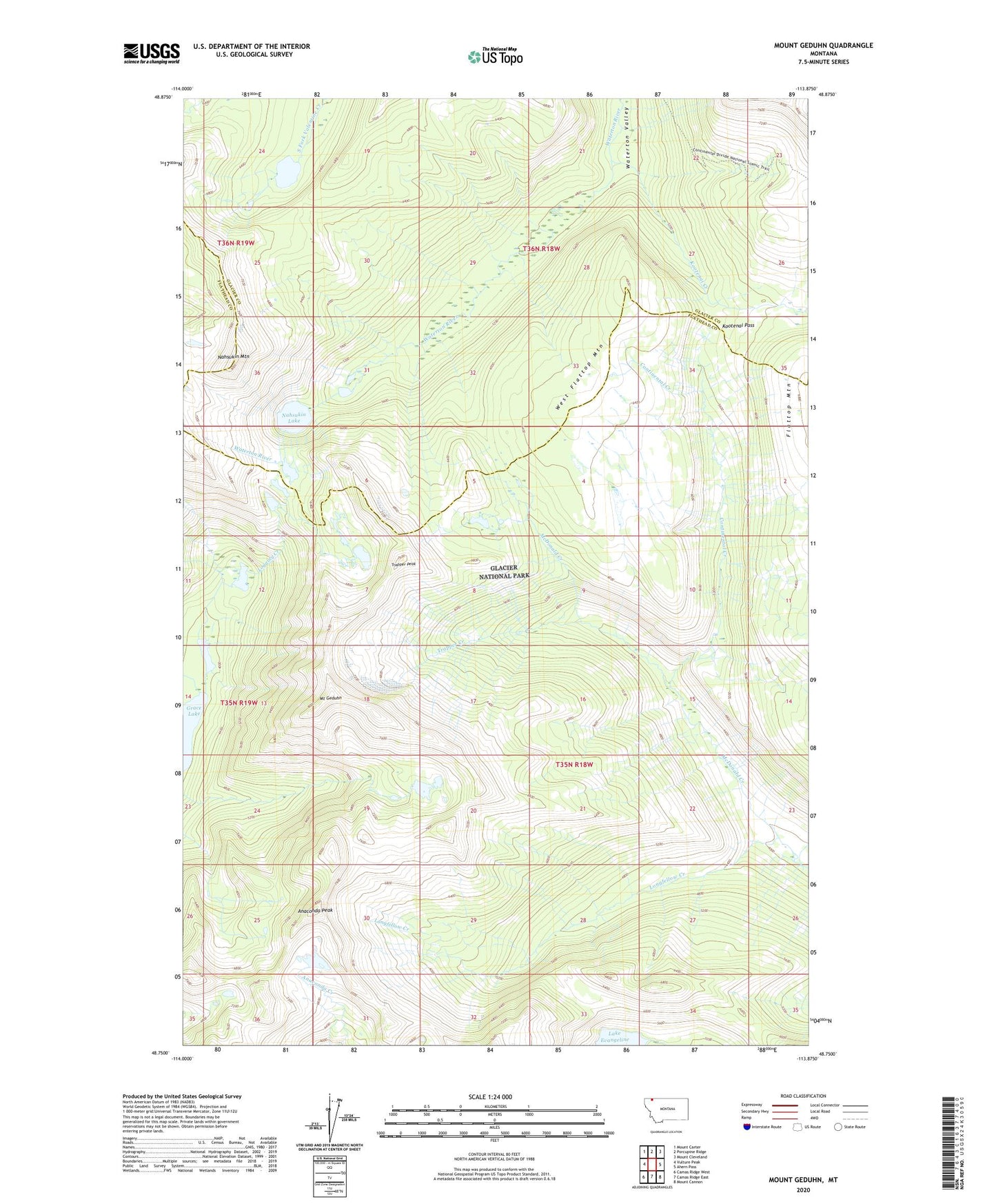
2024 topographic map quadrangle Mount Geduhn in the state of Montana. Scale: 1:24000. Based on the newly updated USGS 7.5' US Topo map series, this map is in the following counties: Flathead, Glacier. The map contains contour data, water features, and other items you are used to seeing on USGS maps, but also has updated roads and other features. This is the next generation of topographic maps. Printed on high-quality waterproof paper with UV fade-resistant inks.
Quads adjacent to this one:
West: Vulture Peak
Northwest: Mount Carter
North: Porcupine Ridge
Northeast: Mount Cleveland
East: Ahern Pass
Southeast: Mount Cannon
South: Camas Ridge East
Southwest: Camas Ridge West
This map covers the same area as the classic USGS quad with code o48113g8.
Contains the following named places: Anaconda Peak, Continental Creek, Grace Lake, Kootenai Creek, Kootenai Pass, Longfellow Creek, Mount Geduhn, Nahsukin Lake, Nahsukin Mountain, Redhorn Lake, Trapper Creek, Trapper Peak, Waterton Valley Trail, West Flattop Mountain