MyTopo
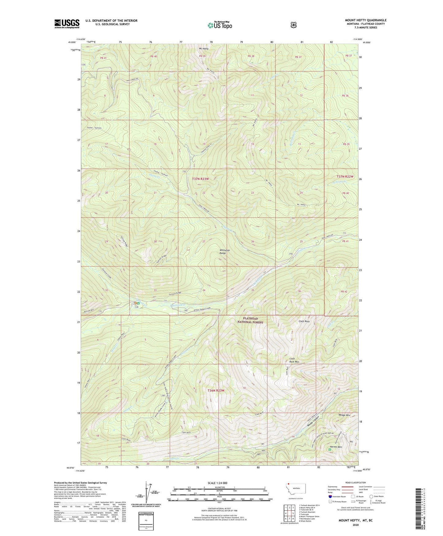
Mount Hefty Montana US Topo Map
Couldn't load pickup availability
Also explore the Mount Hefty Forest Service Topo of this same quad for updated USFS data
2024 topographic map quadrangle Mount Hefty in the state of Montana. Scale: 1:24000. Based on the newly updated USGS 7.5' US Topo map series, this map is in the following counties: Flathead. The map contains contour data, water features, and other items you are used to seeing on USGS maps, but also has updated roads and other features. This is the next generation of topographic maps. Printed on high-quality waterproof paper with UV fade-resistant inks.
Quads adjacent to this one:
West: Tuchuck Mountain
Northwest: Tuchuck Mountain OE N
North: Mount Hefty OE N
Northeast: Trailcreek OE N
East: Trailcreek
Southeast: Whale Buttes
South: Red Meadow Lake
Southwest: Mount Thompson-Seton
This map covers the same area as the classic USGS quad with code o48114h5.
Contains the following named places: Antley Creek, Cleft Rock, Cleft Rock Mountain, Hornet Mountain, Mount Hefty, Seemo Creek, Thoma Creek, Thoma Lookout, Tuchuck Campground, Tuchuck Creek, Yakinikak Creek