MyTopo
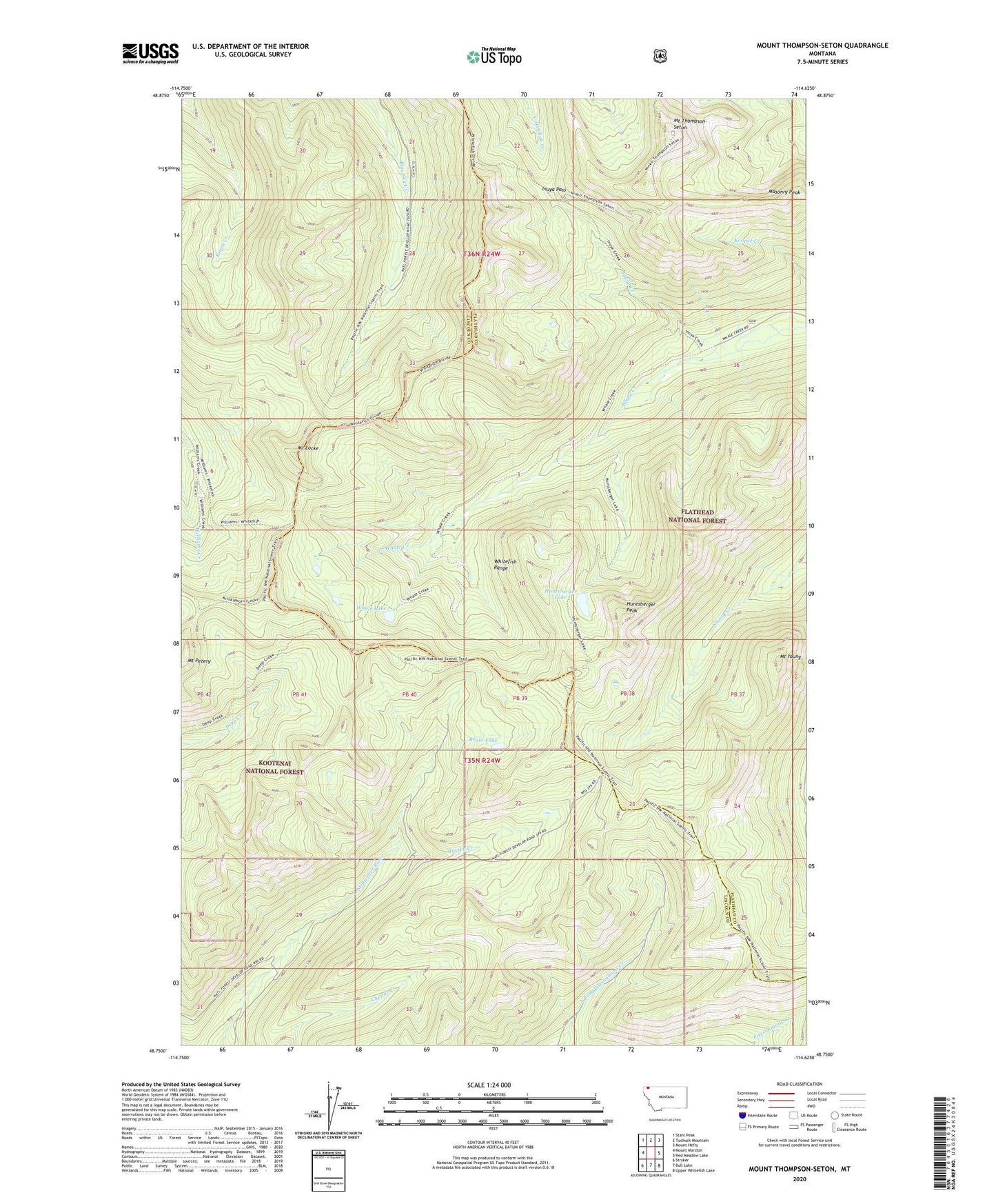
Mount Thompson-Seton Montana US Topo Map
Couldn't load pickup availability
Also explore the Mount Thompson-Seton Forest Service Topo of this same quad for updated USFS data
2024 topographic map quadrangle Mount Thompson-Seton in the state of Montana. Scale: 1:24000. Based on the newly updated USGS 7.5' US Topo map series, this map is in the following counties: Lincoln, Flathead. The map contains contour data, water features, and other items you are used to seeing on USGS maps, but also has updated roads and other features. This is the next generation of topographic maps. Printed on high-quality waterproof paper with UV fade-resistant inks.
Quads adjacent to this one:
West: Mount Marston
Northwest: Stahl Peak
North: Tuchuck Mountain
Northeast: Mount Hefty
East: Red Meadow Lake
Southeast: Upper Whitefish Lake
South: Bull Lake
Southwest: Stryker
This map covers the same area as the classic USGS quad with code o48114g6.
Contains the following named places: Bruin Lake, Huntsberger Lake, Huntsberger Peak, Inuya Creek, Inuya Pass, Locke Lookout, Masonry Peak, Mount Locke, Mount Petery, Mount Thompson-Seton, Mount Young, Russky Creek, Whale Lake