MyTopo
Mount Rae Montana US Topo Map
Couldn't load pickup availability
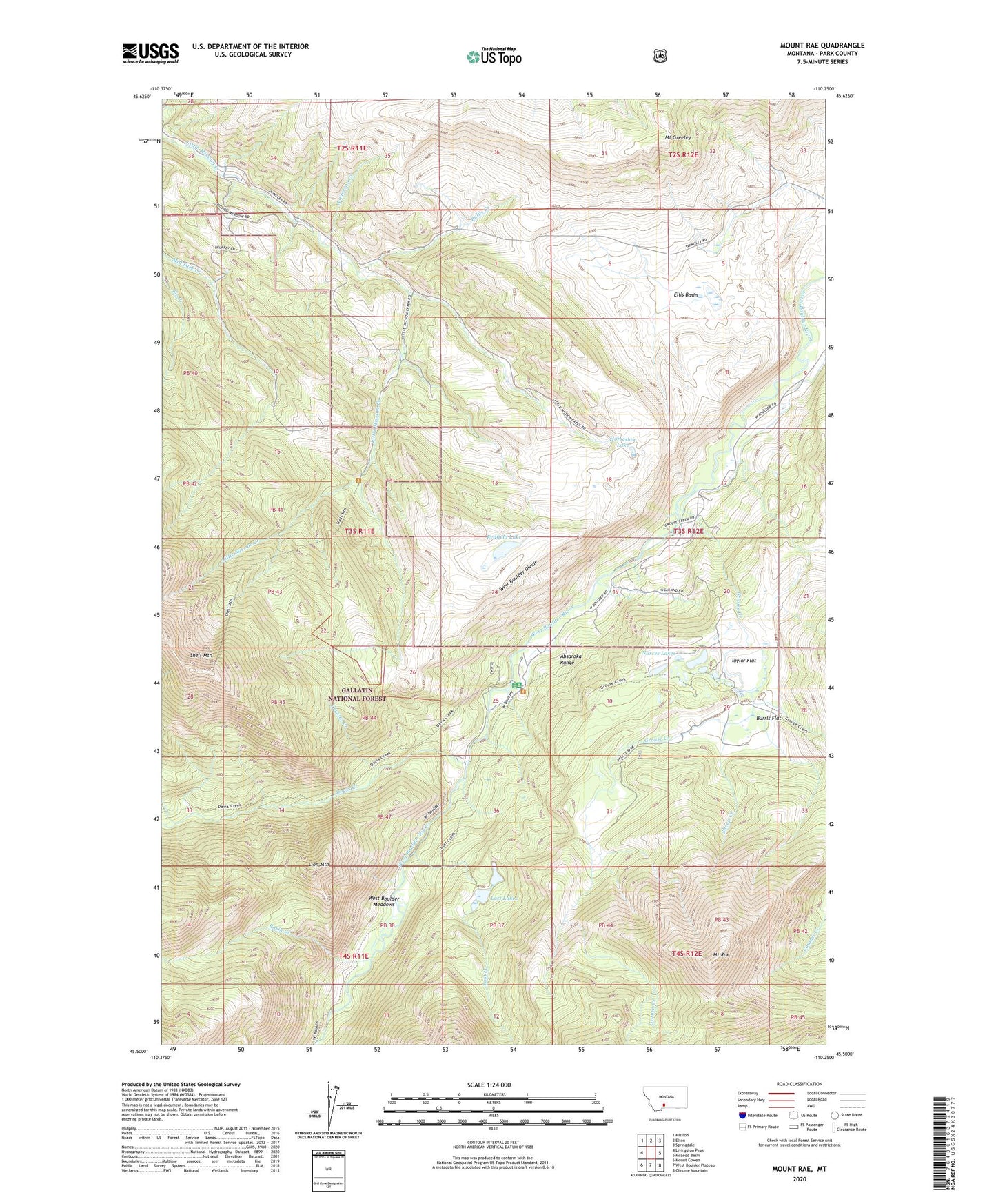
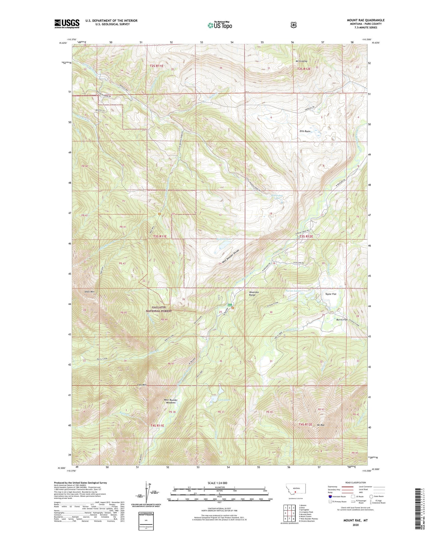
2020 topographic map quadrangle Mount Rae in the state of Montana. Scale: 1:24000. Based on the newly updated USGS 7.5' US Topo map series, this map is in the following counties: Park. The map contains contour data, water features, and other items you are used to seeing on USGS maps, but also has updated roads and other features. This is the next generation of topographic maps. Printed on high-quality waterproof paper with UV fade-resistant inks.
Quads adjacent to this one:
West: Livingston Peak
Northwest: Mission
North: Elton
Northeast: Springdale
East: McLeod Basin
Southeast: Chrome Mountain
South: West Boulder Plateau
Southwest: Mount Cowen
Contains the following named places: Anderson Creek, Bar Twenty Ranch, Basin Creek, Bruffey Homestead, Bruffey School, Bruffeys Post Office, Bullis Creek, Burnt Leather Ranch, Burrls Flat, Canyon Creek, Crystal Creek, Davis Creek, Ellis Basin, Fisher Homestead, Gaylor Homestead, Gordan School, Grouse Creek, Horseshoe Lake, Lamp Homestead, Lion Mountain, Lost Creek, Lost Lakes, McKnight Homestead, Mount Greeley, Mount Rae, Nurses Lakes, Pruitt Park, Redfield Lake, Richards Ranch, Rogers Homestead, Sheep Creek, Swingley Post Office, Swingley Ranch, Taylor Flat, West Boulder Divide, West Boulder Meadows, West Boulder Ranger Station, West Boulder Recreation, West Boulder School