MyTopo
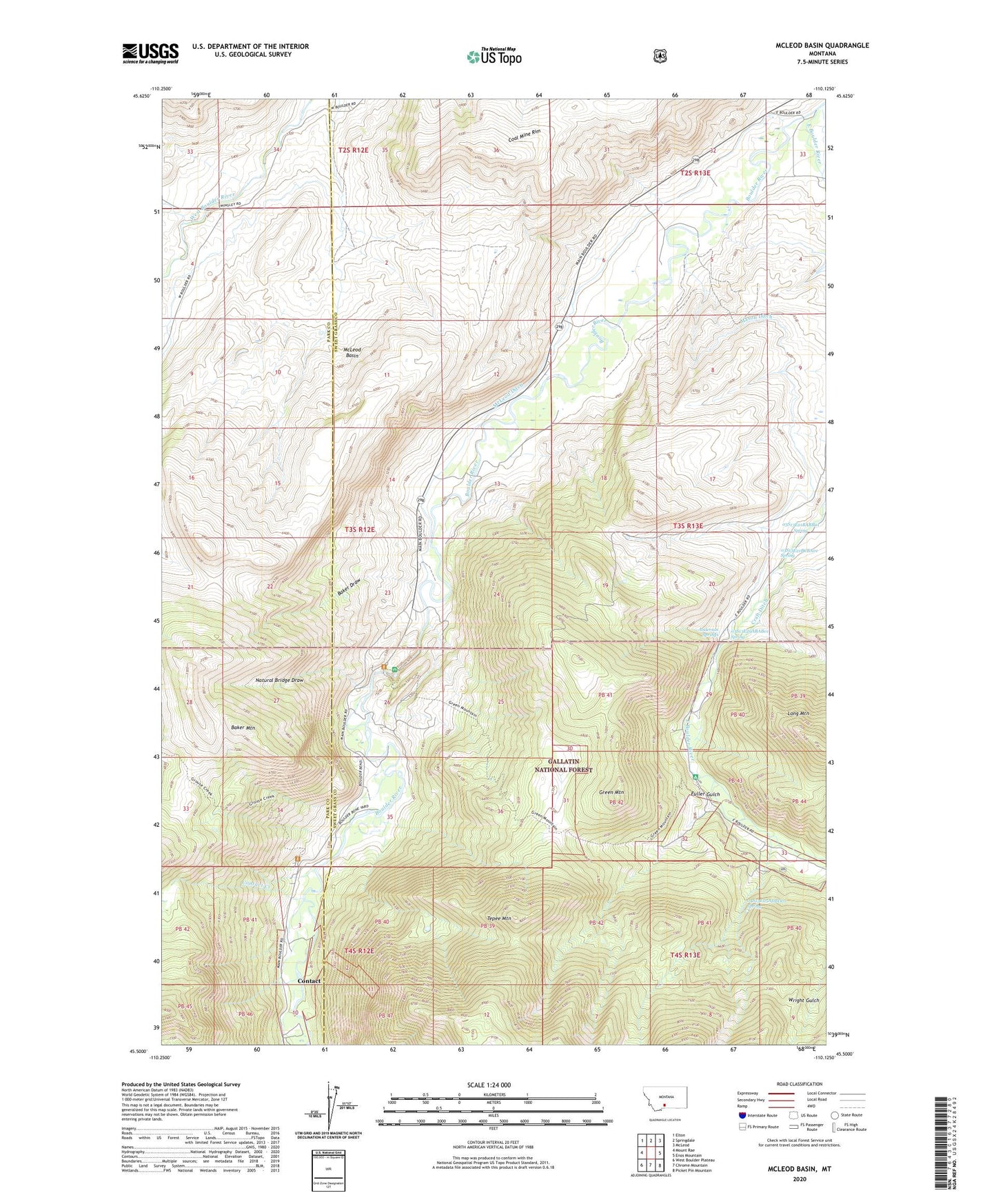
McLeod Basin Montana US Topo Map
Couldn't load pickup availability
Also explore the McLeod Basin Forest Service Topo of this same quad for updated USFS data
2024 topographic map quadrangle McLeod Basin in the state of Montana. Scale: 1:24000. Based on the newly updated USGS 7.5' US Topo map series, this map is in the following counties: Sweet Grass, Park. The map contains contour data, water features, and other items you are used to seeing on USGS maps, but also has updated roads and other features. This is the next generation of topographic maps. Printed on high-quality waterproof paper with UV fade-resistant inks.
Quads adjacent to this one:
West: Mount Rae
Northwest: Elton
North: Springdale
Northeast: McLeod
East: Enos Mountain
Southeast: Picket Pin Mountain
South: Chrome Mountain
Southwest: West Boulder Plateau
This map covers the same area as the classic USGS quad with code o45110e2.
Contains the following named places: 02S13E33CDAD01 Well, 03S12E12DACA01 Well, 03S12E13BCDA01 Well, 03S12E13CBBA01 Well, 03S13E05BACD01 Well, 03S13E05CBBB01 Well, 03S13E07BABD01 Well, 03S13E21BABB01 Spring, 03S13E21BCBA01 Spring, 03S13E29ABAB01 Spring, 04S13E05ADBD01 Spring, Anderson Springs, Baker Draw, Baker Mountain, Coal Mine Rim, Contact, Contact Creek, Contact Post Office, Contact School, East Boulder Campground, East Boulder River, Fuller Gulch, Green Mountain, Hubble Post Office, Main Boulder Ranger Station, Mason Ditch, McLeod Basin, McLeod Ditch, McLeod School, Natural Bridge Draw, Natural Bridge Point of Interest, Natural Bridge State Park, Old Kaintuck Guest Ranch, Tepee Mountain