MyTopo
Chrome Mountain Montana US Topo Map
Couldn't load pickup availability
Also explore the Chrome Mountain Forest Service Topo of this same quad for updated USFS data
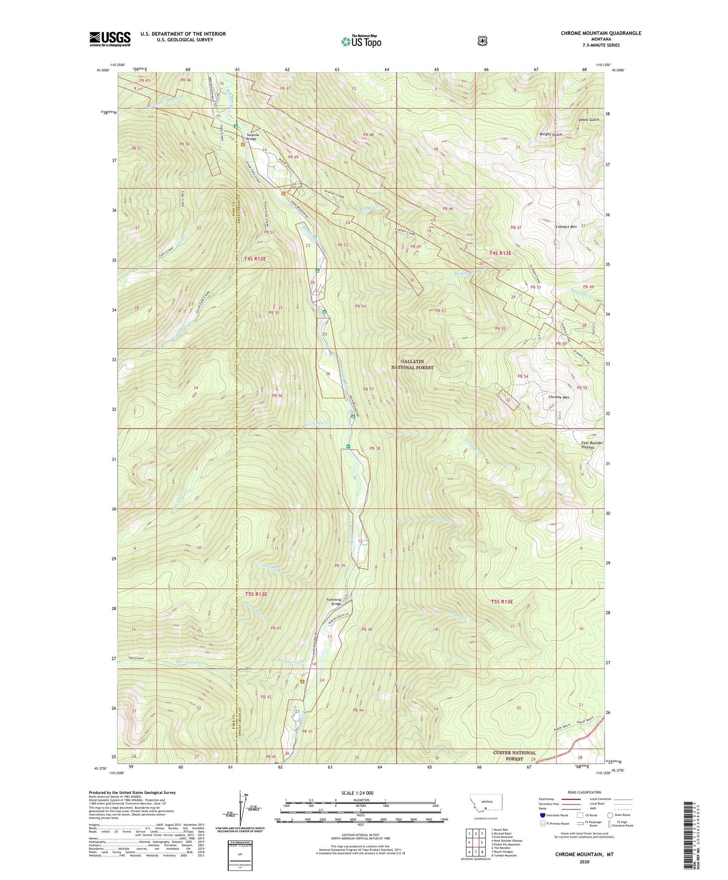
2024 topographic map quadrangle Chrome Mountain in the state of Montana. Scale: 1:24000. Based on the newly updated USGS 7.5' US Topo map series, this map is in the following counties: Sweet Grass, Park. The map contains contour data, water features, and other items you are used to seeing on USGS maps, but also has updated roads and other features. This is the next generation of topographic maps. Printed on high-quality waterproof paper with UV fade-resistant inks.
Quads adjacent to this one:
West: West Boulder Plateau
Northwest: Mount Rae
North: McLeod Basin
Northeast: Enos Mountain
East: Picket Pin Mountain
Southeast: Tumble Mountain
South: Mount Douglas
Southwest: The Needles
This map covers the same area as the classic USGS quad with code o45110d2.
Contains the following named places: 04S12E25CBBD02 Well, 59052, Aspen Campground, Big Beaver Campground, Blakely Creek, Bonanza Number 3 Mine, Boulder River Number 1 Mine, Camp-on-the-Boulder, Chippy Park Campground, Chrome Mountain, Clydehurst Ranch, Contact Mountain, East Chippy Creek, Falls Creek, Falls Creek Campground, Firewater Creek, Flemming Bridge, Froze-to-Death Creek, Gish Mine, Graham Creek, Great Falls Creek, Hells Canyon Ranch, Lower Gish Mine, Middle Gish Mine, Miller Creek, Nicon Number 1 Mine, Raspberry Creek, Red Fox Claim Mine, Shorty Creek, Silvertip Creek, Skillman Mine, Speculator Creek, Twomile Bridge, Upper Gish Mine, West Chippy Creek