MyTopo
Mountain House Montana US Topo Map
Couldn't load pickup availability
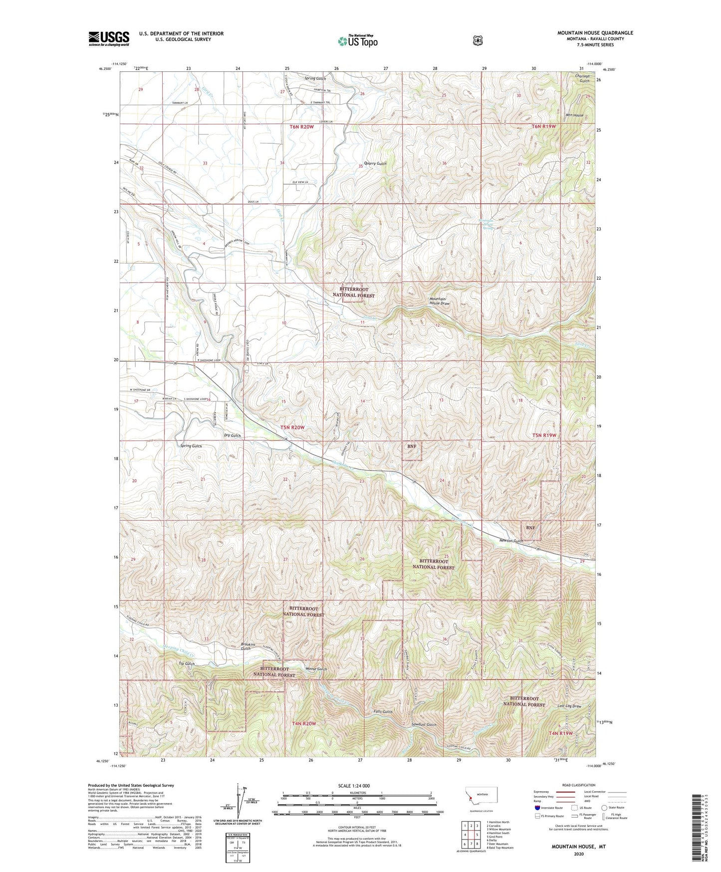
2020 topographic map quadrangle Mountain House in the state of Montana. Scale: 1:24000. Based on the newly updated USGS 7.5' US Topo map series, this map is in the following counties: Ravalli. The map contains contour data, water features, and other items you are used to seeing on USGS maps, but also has updated roads and other features. This is the next generation of topographic maps. Printed on high-quality waterproof paper with UV fade-resistant inks.
Quads adjacent to this one:
West: Hamilton South
Northwest: Hamilton North
North: Corvallis
Northeast: Willow Mountain
East: Gird Point
Southeast: Bald Top Mountain
South: Deer Mountain
Southwest: Darby
Contains the following named places: 05N20W04ACD_01 Well, 05N20W10BAAC01 Well, 05N20W23BAC_01 Well, 05N20W23BBA_01 Well, 05N20W33BCCD01 Well, Blacktail Creek, Brookins Gulch, Dry Gulch, Falls Gulch, Hamilton Division, Hamilton Golf Course, Moose Gulch, Mountain House, Mountain House Draw, Mountain House Spring, Newton Gulch, Quarry Gulch, Saint Clair Creek, Sawdust Gulch, Skalkaho Highline Ditch, Spring Gulch, SW NE Section 2 Mine, Tip Gulch, Twomile Creek, Ward Ditch