MyTopo
N Bar Coulee Montana US Topo Map
Couldn't load pickup availability
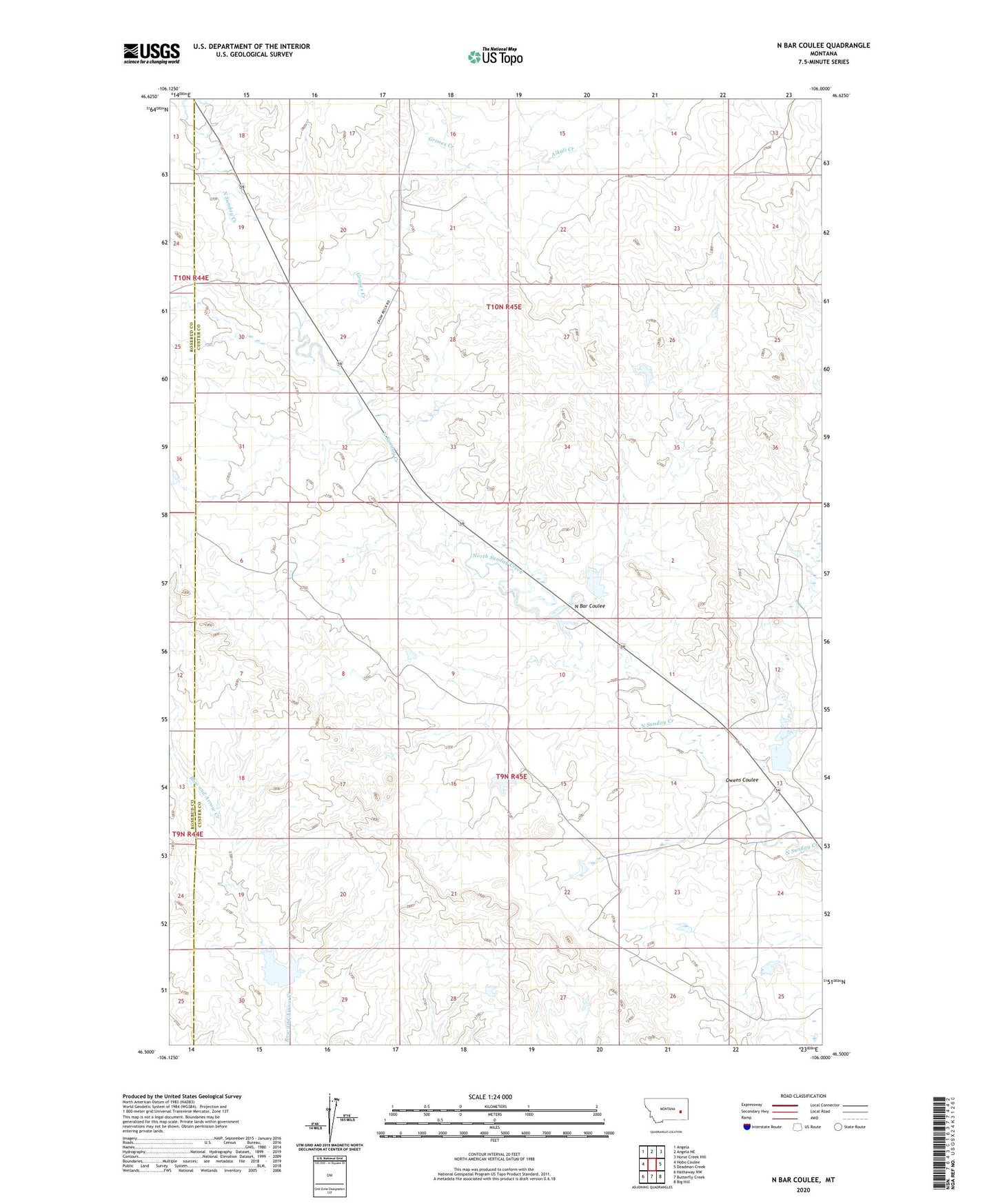
2024 topographic map quadrangle N Bar Coulee in the state of Montana. Scale: 1:24000. Based on the newly updated USGS 7.5' US Topo map series, this map is in the following counties: Custer, Rosebud. The map contains contour data, water features, and other items you are used to seeing on USGS maps, but also has updated roads and other features. This is the next generation of topographic maps. Printed on high-quality waterproof paper with UV fade-resistant inks.
Quads adjacent to this one:
West: Hobo Coulee
Northwest: Angela
North: Angela NE
Northeast: Horse Creek Hill
East: Deadman Creek
Southeast: Big Hill
South: Butterfly Creek
Southwest: Hathaway NW
This map covers the same area as the classic USGS quad with code o46106e1.
Contains the following named places: 10N45E28BBBA01 Well, 10N45E28BBBA02 Well, 10N45E28BBBB01 Well, Alkali Creek, Brewer Number 2 Dam, Grimes Creek, Harding Number 1 Dam, Harding Number 2 Dam, N Bar Coulee, Owens Coulee, Stone Shack, Stone Shack Post Office, Venn Number 1 Dam, Venn Number 4 Dam, Venn Number 7 Dam, Venn Number 8 Dam, Venn Number 9 Dam, Venn Ranch