MyTopo
Niarada Montana US Topo Map
Couldn't load pickup availability
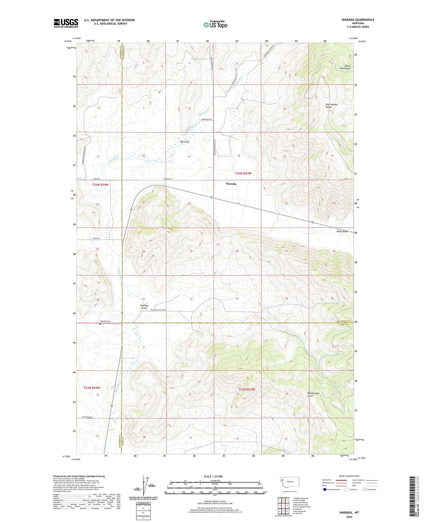
2024 topographic map quadrangle Niarada in the state of Montana. Scale: 1:24000. Based on the newly updated USGS 7.5' US Topo map series, this map is in the following counties: Flathead, Lake, Sanders. The map contains contour data, water features, and other items you are used to seeing on USGS maps, but also has updated roads and other features. This is the next generation of topographic maps. Printed on high-quality waterproof paper with UV fade-resistant inks.
Quads adjacent to this one:
West: Mill Pocket Creek
Northwest: Hubbart Reservoir
North: Kofford Ridge
Northeast: Lake Mary Ronan
East: Irvine Lookout Tower
Southeast: Irvine Hill
South: Hot Springs NE
Southwest: Lonepine
This map covers the same area as the classic USGS quad with code o47114g5.
Contains the following named places: 23N24W13DBBA01 Well, 24N23W09BAA_01 Well, 24N23W16BCC_01 Well, 24N23W17DAC_01 Well, 24N23W20AAB_01 Well, 24N23W21BCDA01 Well, 24N24W24ABBB01 Well, 24N24W24ABBB02 Well, 24N24W25DDBB01 Well, Battle Butte School, Big Draw, Cromwell Creek, Deep Draw, Flathead Reservation Division, Niarada, Niarada Cemetery, Niarada Census Designated Place, Niarada Post Office, Niarada School, Sullivan Gulch