MyTopo
Irvine Hill Montana US Topo Map
Couldn't load pickup availability
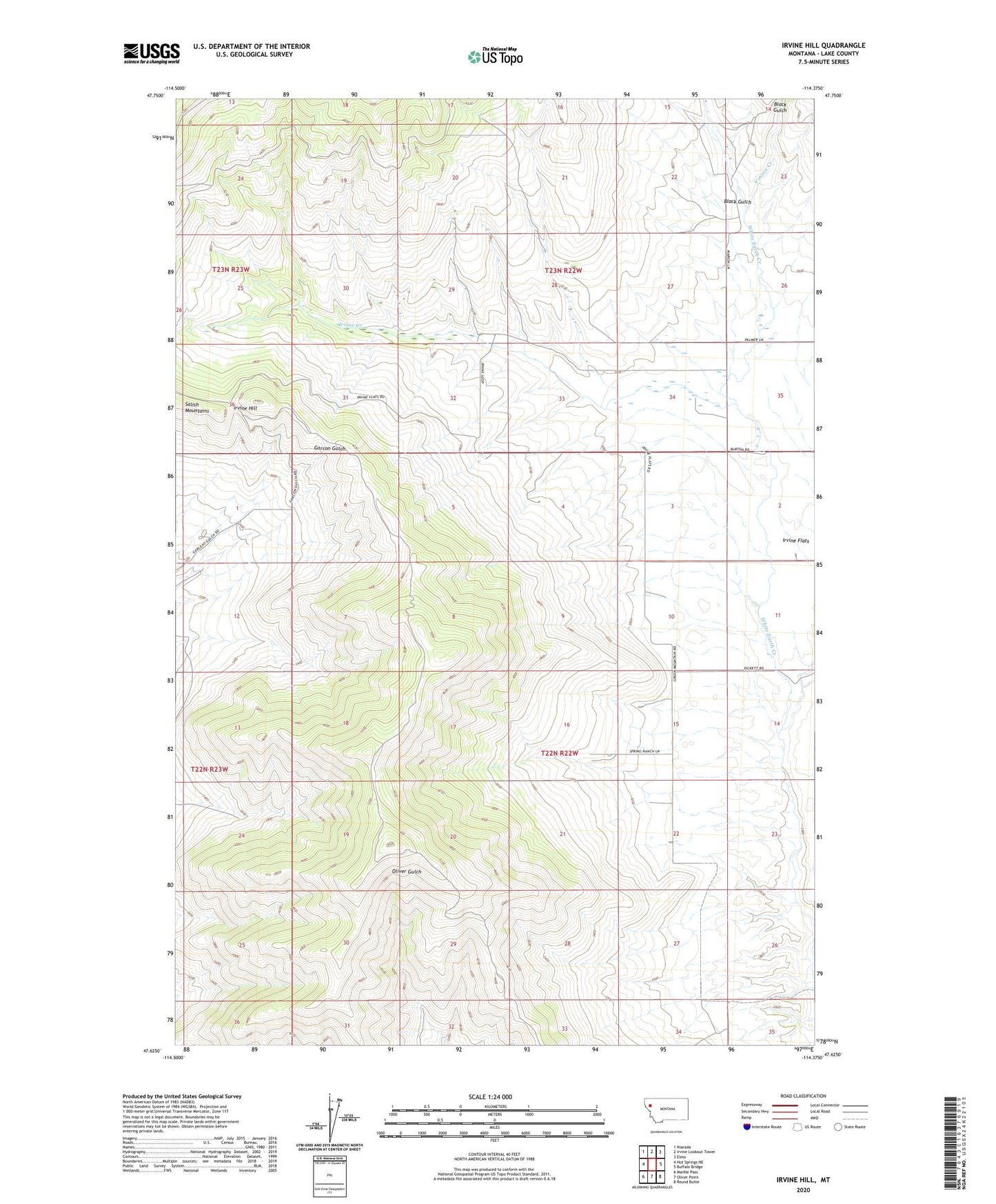
2024 topographic map quadrangle Irvine Hill in the state of Montana. Scale: 1:24000. Based on the newly updated USGS 7.5' US Topo map series, this map is in the following counties: Lake. The map contains contour data, water features, and other items you are used to seeing on USGS maps, but also has updated roads and other features. This is the next generation of topographic maps. Printed on high-quality waterproof paper with UV fade-resistant inks.
Quads adjacent to this one:
West: Hot Springs NE
Northwest: Niarada
North: Irvine Lookout Tower
Northeast: Elmo
East: Buffalo Bridge
Southeast: Round Butte
South: Oliver Point
Southwest: Markle Pass
This map covers the same area as the classic USGS quad with code o47114f4.
Contains the following named places: 22N19W32BCAD01 Well, 22N22W02DCD_01 Well, 22N22W04ABA_01 Well, 22N22W22BABC01 Well, 23N22W26BDCC01 Well, 23N22W35CDB_01 Well, 24N22W30BCAC01 Well, Black Gulch, Green Mountain School, Irvine Creek, Irvine Flats, Irvine Hill, Vinson Creek