MyTopo
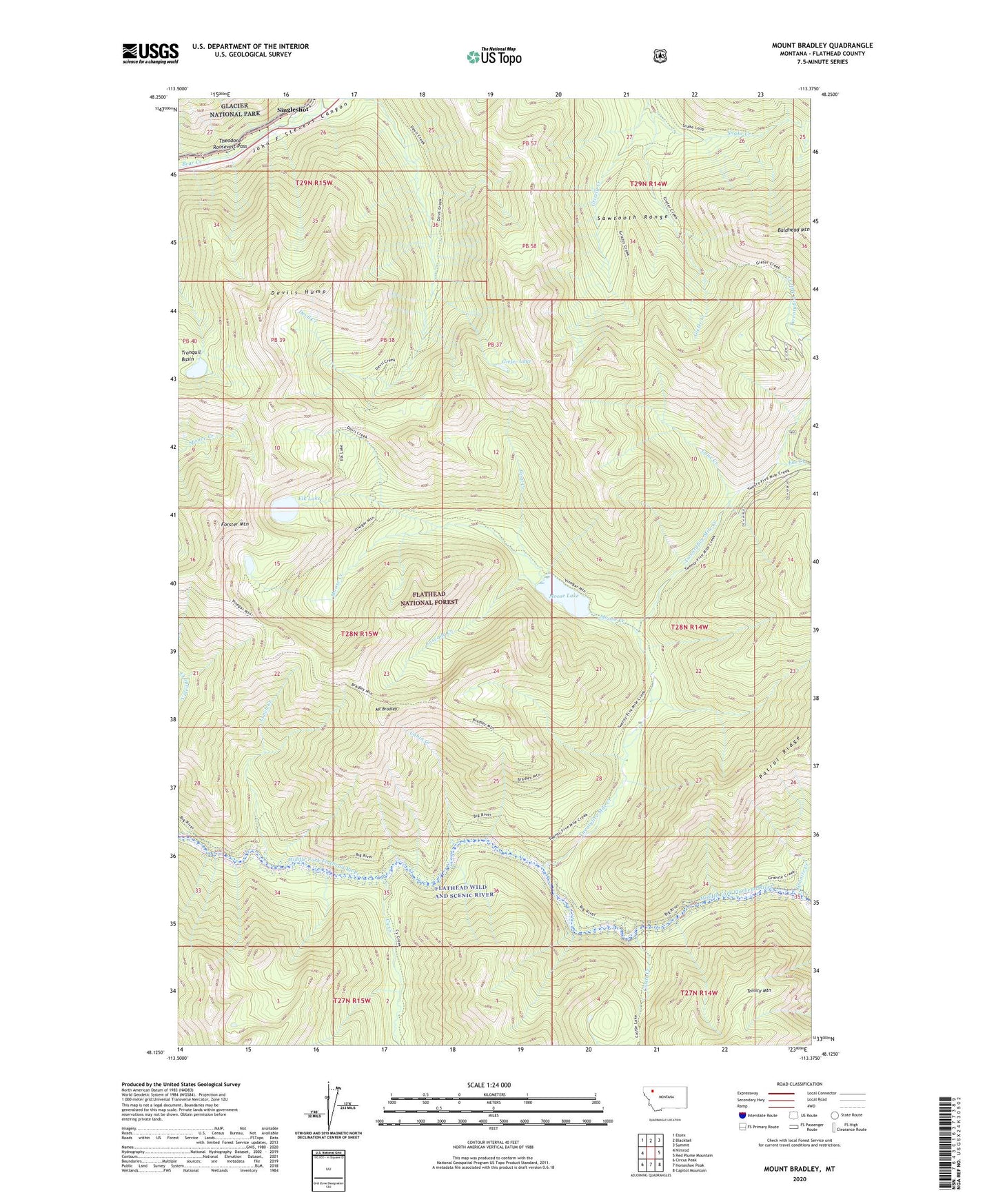
Mount Bradley Montana US Topo Map
Couldn't load pickup availability
Also explore the Mount Bradley Forest Service Topo of this same quad for updated USFS data
2024 topographic map quadrangle Mount Bradley in the state of Montana. Scale: 1:24000. Based on the newly updated USGS 7.5' US Topo map series, this map is in the following counties: Flathead. The map contains contour data, water features, and other items you are used to seeing on USGS maps, but also has updated roads and other features. This is the next generation of topographic maps. Printed on high-quality waterproof paper with UV fade-resistant inks.
Quads adjacent to this one:
West: Nimrod
Northwest: Essex
North: Blacktail
Northeast: Summit
East: Red Plume Mountain
Southeast: Capitol Mountain
South: Horseshoe Peak
Southwest: Circus Peak
This map covers the same area as the classic USGS quad with code o48113b4.
Contains the following named places: Big River Trail, Cabin Creek, Cascade Creek, Castle Creek, Cy Creek, Devil Creek Trail, Devils Hump, Ear Creek, Elk Lake, Forster Mountain, Giefer Lake, Giefer Twentyfive Mile Creek Trail, Goal Creek, Granite Cabin, Granite Creek, Great Bear Wilderness, Grizzly Creek, Lunch Creek, Lynx Creek, Moose Creek, Moose Lake, Mount Bradley, Mount Bradley Trail, Singleshot, Snake Creek, Snake Creek Loop, Spruce Park Moose Lake Trail, Twentyfive Mile Creek, Windy Hill