MyTopo
North Coulee Montana US Topo Map
Couldn't load pickup availability
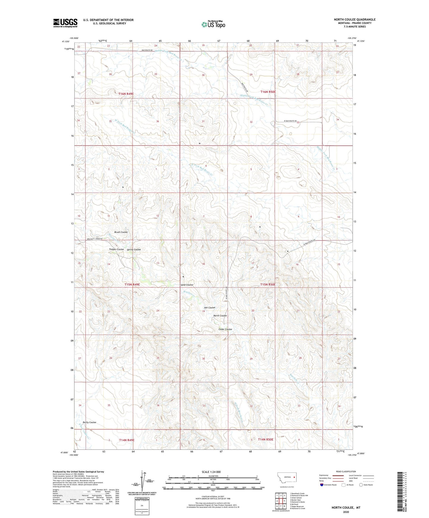
2024 topographic map quadrangle North Coulee in the state of Montana. Scale: 1:24000. Based on the newly updated USGS 7.5' US Topo map series, this map is in the following counties: Prairie. The map contains contour data, water features, and other items you are used to seeing on USGS maps, but also has updated roads and other features. This is the next generation of topographic maps. Printed on high-quality waterproof paper with UV fade-resistant inks.
Quads adjacent to this one:
West: Becker Dam
Northwest: Bearshack Creek
North: Diamond G Butte NW
Northeast: Union School
East: Diamond G Butte
Southeast: Diamond G Creek
South: Papps Reservoir
Southwest: McCloud
This map covers the same area as the classic USGS quad with code o47105a4.
Contains the following named places: 15N49E14ADA_01 Well, 15N49E14BCA_01 Well, 15N50E17CAAA01 Well, 15N50E19BBAB01 Well, 15N50E31CDDA01 Well, 16N49E35DDA_01 Well, 16N50E28DAD_01 Well, Ash Coulee, Brush Coulee, Cedar Coulee, Dersham School, North Coulee, Reilly Coulee, Sand Coulee, Spring Coulee, Timber Coulee