MyTopo
Bearshack Creek Montana US Topo Map
Couldn't load pickup availability
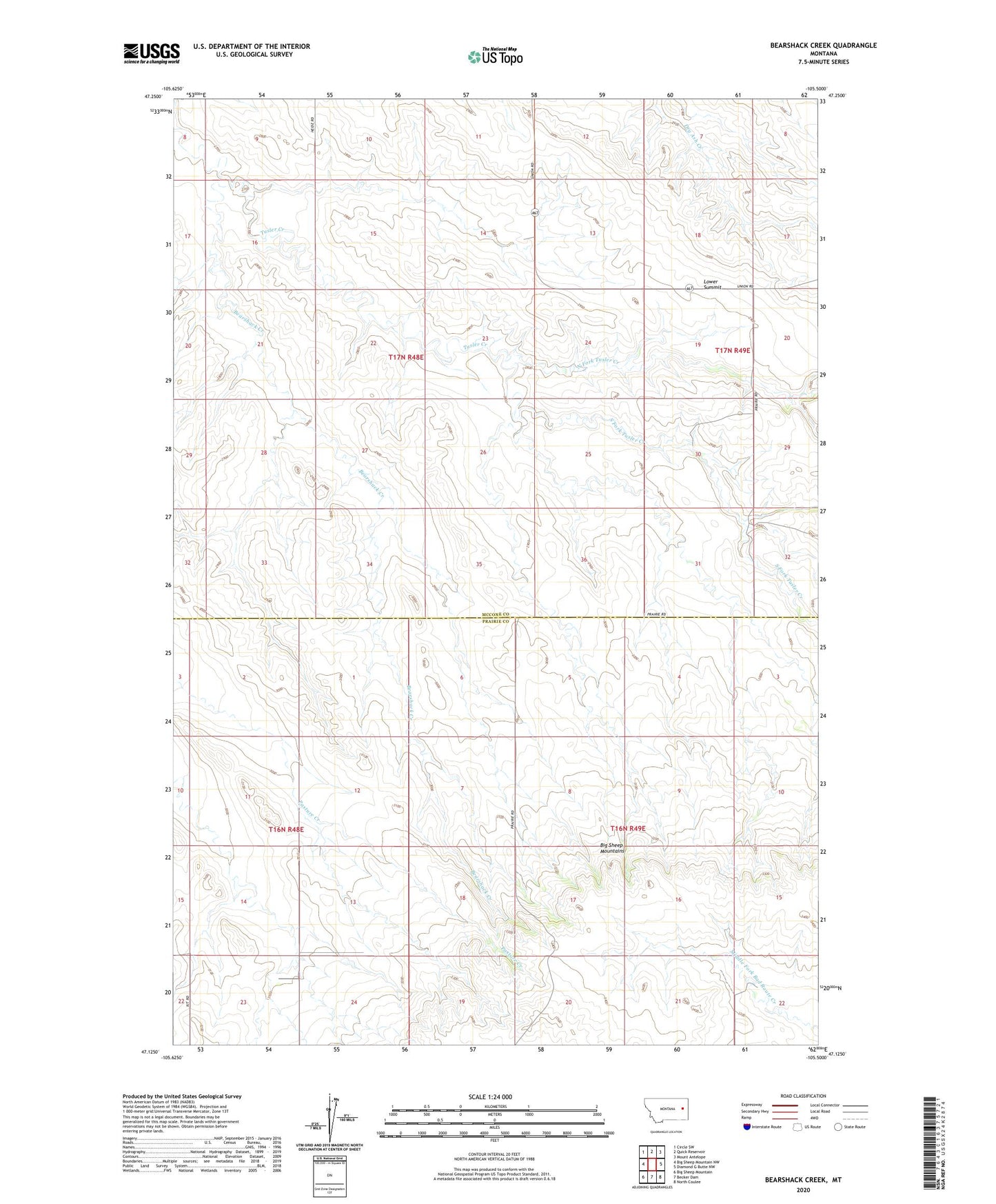
2024 topographic map quadrangle Bearshack Creek in the state of Montana. Scale: 1:24000. Based on the newly updated USGS 7.5' US Topo map series, this map is in the following counties: McCone, Prairie. The map contains contour data, water features, and other items you are used to seeing on USGS maps, but also has updated roads and other features. This is the next generation of topographic maps. Printed on high-quality waterproof paper with UV fade-resistant inks.
Quads adjacent to this one:
West: Big Sheep Mountain NW
Northwest: Circle SW
North: Quick Reservoir
Northeast: Mount Antelope
East: Diamond G Butte NW
Southeast: North Coulee
South: Becker Dam
Southwest: Big Sheep Mountain
This map covers the same area as the classic USGS quad with code o47105b5.
Contains the following named places: 16N48E01ACC_01 Well, 16N48E02CCD_01 Well, 16N49E16DDDD01 Well, 16N49E21BBBB01 Well, 17N48E12ADDA01 Well, 17N48E35DBBA01 Well, 17N49E17BCBD01 Well, Bearshack Creek, Lower Summit, North Fork Tusler Creek, Pleasant Ridge School, Schwartz Dam, South Fork Tusler Creek, Sunshine School, Tularski School