MyTopo
Northeast Missoula Montana US Topo Map
Couldn't load pickup availability
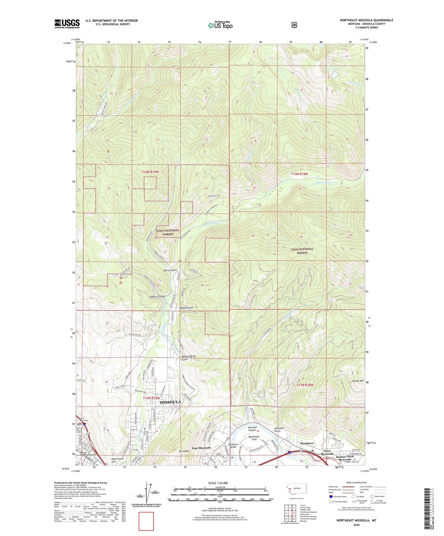
2020 topographic map quadrangle Northeast Missoula in the state of Montana. Scale: 1:24000. Based on the newly updated USGS 7.5' US Topo map series, this map is in the following counties: Missoula. The map contains contour data, water features, and other items you are used to seeing on USGS maps, but also has updated roads and other features. This is the next generation of topographic maps. Printed on high-quality waterproof paper with UV fade-resistant inks.
Quads adjacent to this one:
West: Northwest Missoula
Northwest: Evaro
North: Stuart Peak
Northeast: Wapiti Lake
East: Blue Point
Southeast: Bonner
South: Southeast Missoula
Southwest: Southwest Missoula
Contains the following named places: 13N19W10DC__01 Well, 13N19W11BA__01 Well, 13N19W11DB__01 Well, 13N19W11DC__01 Well, 13N19W12BB__01 Well, 13N19W12BB__02 Well, 13N19W12BBBB01 Well, 13N19W13AD__01 Well, 13N19W13AD__02 Well, 13N19W14BAAA01 Well, 13N19W14DB__01 Well, 13N19W15DA__01 Well, 13N19W24ABCA01 Well, 14N19W15BABD01 Well, 14N19W35DD__01 Well, 14N19W36BBCC01 Well, 59802, Bandmann Bridge, Bandmann Flats, Big Pines Mobile Court, Bonner-West Riverside Census Designated Place, Carols Court, Christ Church of Missoula, Circle 'J' Mobile Park, Clark Fork School, Danny O'Brien Gulch, East Fork Grant Creek, East Missoula Census Designated Place, Fraser Creek, Greenland Park Trailer Court, Greenough Park, Harveys Mobile Home Court, Junction of the Hell Gate and Big Blackfoot Rivers Historical Marker, KYLT-AM (Missoula), KZOQ-FM (Missoula), Lincoln School Baptist Church, Marshall Canyon, Marshall Creek, Marshall Ski Area, Messiah Lutheran Church, Milltown Post Office, Mittower Gulch, Mount Jumbo, Mountain View Court, Northside Park, Orange Street Underpass, Partnership Health Center, Peterson Lake Dam, Pilcher Creek, Pinegrove, Pinegrove Trailer Park, Pineview Park, Quast Ditch, Rattlesnake School, Royal Court, Saint Josephs Elementary School, Saint Mary Cemetery, Saint Patrick Hospital, Saint Patrick Hospital Life Flight, Sawmill Gulch, Sha Ron Fishing Access Site, Spring Gulch, Swedish Community Church, Waterworks Hill, West Riverside, Whittier School, Williams Ditch, Woods Gulch, Woody Mountain