
MyTopo
Olson Coulee South Montana US Topo Map
Couldn't load pickup availability
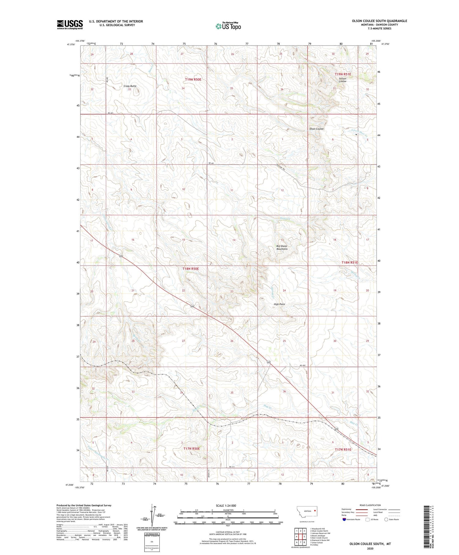
2020 topographic map quadrangle Olson Coulee South in the state of Montana. Scale: 1:24000. Based on the newly updated USGS 7.5' US Topo map series, this map is in the following counties: Dawson. The map contains contour data, water features, and other items you are used to seeing on USGS maps, but also has updated roads and other features. This is the next generation of topographic maps. Printed on high-quality waterproof paper with UV fade-resistant inks.
Quads adjacent to this one:
West: Mount Antelope
Northwest: Woodworth Hill
North: Olson Coulee North
Northeast: Johnson Reservoir NW
East: Deer Creek Church
Southeast: Lindsay
South: Union School
Southwest: Diamond G Butte NW
Contains the following named places: 17N50E05ACD_01 Well, 18N50E04ABD_01 Well, 18N50E16CBB_01 Well, 18N50E16CBBB01 Well, 18N50E25DA__01 Well, 18N50E34DDA_01 Well, 18N50E34DDA_02 Well, 18N51E07BC__01 Well, 19N51E29CCA_01 Well, Big Sheep Mountains, Crazy Butte, High Point, High Point School, Mink, Mink Post Office, Rimroad, Rimroad Post Office, Sioux Creek School


