MyTopo
Deer Creek Church Montana US Topo Map
Couldn't load pickup availability
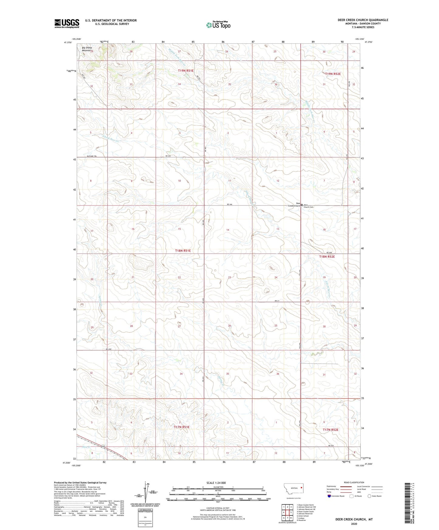
2024 topographic map quadrangle Deer Creek Church in the state of Montana. Scale: 1:24000. Based on the newly updated USGS 7.5' US Topo map series, this map is in the following counties: Dawson. The map contains contour data, water features, and other items you are used to seeing on USGS maps, but also has updated roads and other features. This is the next generation of topographic maps. Printed on high-quality waterproof paper with UV fade-resistant inks.
Quads adjacent to this one:
West: Olson Coulee South
Northwest: Olson Coulee North
North: Johnson Reservoir NW
Northeast: Johnson Reservoir NE
East: Johnson Reservoir
Southeast: Woodrow
South: Lindsay
Southwest: Union School
This map covers the same area as the classic USGS quad with code o47105c2.
Contains the following named places: 17N51E02DDD_01 Well, 18N51E03DDA_01 Well, 18N51E13DAA_01 Well, 18N51E15CC__01 Well, 18N51E28DDD_01 Well, 18N51E34DAA_01 Well, 19N51E17DDA_01 Well, 19N51E35CAA_01 Well, 59339, Bickness School, Bradbury School, Centerville School, Deer Creek Church, Slagsvold School, Spring Valley School, West Church Cemetery