MyTopo
Woodworth Hill Montana US Topo Map
Couldn't load pickup availability
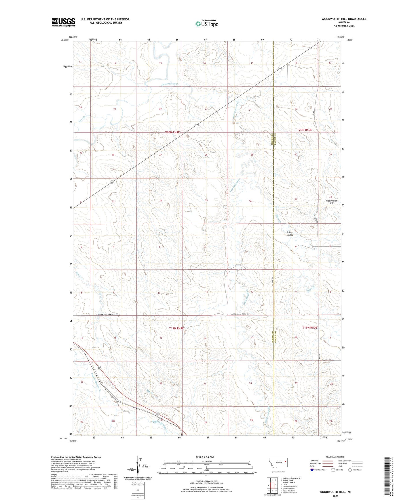
2024 topographic map quadrangle Woodworth Hill in the state of Montana. Scale: 1:24000. Based on the newly updated USGS 7.5' US Topo map series, this map is in the following counties: McCone, Dawson. The map contains contour data, water features, and other items you are used to seeing on USGS maps, but also has updated roads and other features. This is the next generation of topographic maps. Printed on high-quality waterproof paper with UV fade-resistant inks.
Quads adjacent to this one:
West: Circle
Northwest: Hudiburgh Reservoir SE
North: Buffalo Creek
Northeast: Buffalo Creek SE
East: Olson Coulee North
Southeast: Olson Coulee South
South: Mount Antelope
Southwest: Quick Reservoir
This map covers the same area as the classic USGS quad with code o47105d4.
Contains the following named places: 19N49E01CCCC01 Well, 19N49E02DDDC01 Well, 19N49E13CABA01 Well, 19N49E13CACD01 Well, 19N49E13CACD02 Well, 19N49E14AABA01 Well, 19N49E21ACAB01 Well, 19N49E22CBCB01 Well, 19N49E27ABBC01 Well, 19N49E27BABB01 Well, 19N50E17BCD_01 Well, 20N49E17ADDA01 Well, 20N49E24CCDC01 Well, 20N49E26DAAB01 Well, 20N49E26DAAB02 Well, 20N49E27AADC01 Well, 20N49E28DABC01 Well, 20N49E34DDCC01 Well, 20N49E35AADD01 Well, 20N50E18BDCD01 Well, 20N50E18CDDA01 Well, 20N50E19DACB01 Well, 20N50E30AAAB01 Well, 20N50E30AABD01 Well, Cottonwood Creek, Dusing School, James-Smith Dam, Jonas Number 1 Dam, Lost Creek, Sioux Creek, Snowfall Dam, Stilson Coulee, Voss Number 1 Dam, West Fork Buffalo Springs Creek, Woodworth Hill