MyTopo
Olson Peak Montana US Topo Map
Couldn't load pickup availability
Also explore the Olson Peak Forest Service Topo of this same quad for updated USFS data
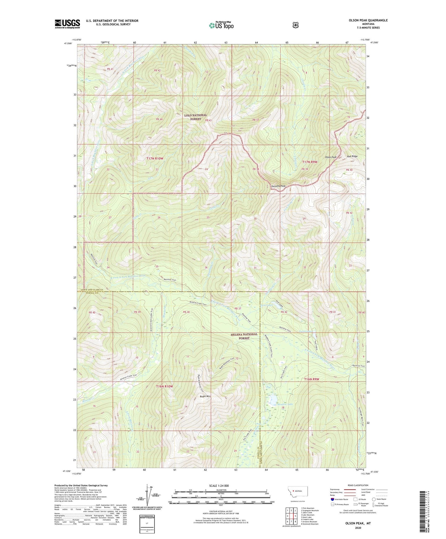
2024 topographic map quadrangle Olson Peak in the state of Montana. Scale: 1:24000. Based on the newly updated USGS 7.5' US Topo map series, this map is in the following counties: Lewis and Clark, Powell. The map contains contour data, water features, and other items you are used to seeing on USGS maps, but also has updated roads and other features. This is the next generation of topographic maps. Printed on high-quality waterproof paper with UV fade-resistant inks.
Quads adjacent to this one:
West: Lake Mountain
Northwest: Flint Mountain
North: Scapegoat Mountain
Northeast: Jakie Creek
East: Heart Lake
Southeast: Stonewall Mountain
South: Arrastra Mountain
Southwest: Coopers Lake
This map covers the same area as the classic USGS quad with code o47112b7.
Contains the following named places: Bugle Mountain, Camp Creek, Cooney Creek Trail, East Fork Meadow Creek, East Fork Mineral Creek, Galusha Peak, Lost Pony Creek, Meadow Creek, Meadow Creek Trail, Meadow Lake, Mineral Creek, Olson Peak, Red Ridge, Sarbo Creek, Scotty Creek, Sourdough Creek, South Creek, Spaulding Creek, Twin Lakes