MyTopo
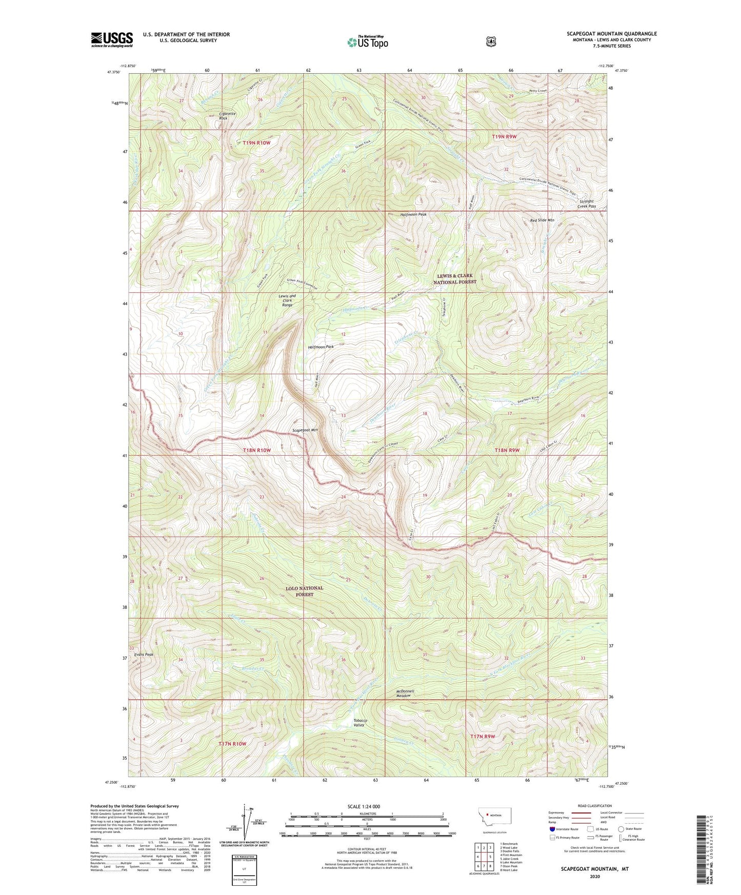
Scapegoat Mountain Montana US Topo Map
Couldn't load pickup availability
Also explore the Scapegoat Mountain Forest Service Topo of this same quad for updated USFS data
2024 topographic map quadrangle Scapegoat Mountain in the state of Montana. Scale: 1:24000. Based on the newly updated USGS 7.5' US Topo map series, this map is in the following counties: Lewis and Clark. The map contains contour data, water features, and other items you are used to seeing on USGS maps, but also has updated roads and other features. This is the next generation of topographic maps. Printed on high-quality waterproof paper with UV fade-resistant inks.
Quads adjacent to this one:
West: Flint Mountain
Northwest: Benchmark
North: Wood Lake
Northeast: Double Falls
East: Jakie Creek
Southeast: Heart Lake
South: Olson Peak
Southwest: Lake Mountain
This map covers the same area as the classic USGS quad with code o47112c7.
Contains the following named places: Broadus Creek, Carmichael Guard Station, Cave Creek, Cigarette Creek Trail, Cigarette Rock, Cooney Creek, Dobrota Creek, Eagle Creek, Green Fork Guard Station, Green Fork Straight Creek, Halfmoon Creek, Halfmoon Dearborn River Trail, Halfmoon Park, Halfmoon Peak, Lost Cabin Cave Creek Trail, McDonnell Meadow, Red Slide Mountain, Scapegoat Mountain, Scapegoat Wilderness, Straight Creek Pass, Telephone Creek, Theodore Creek, Tobacco Valley