MyTopo
Overwhich Falls Montana US Topo Map
Couldn't load pickup availability
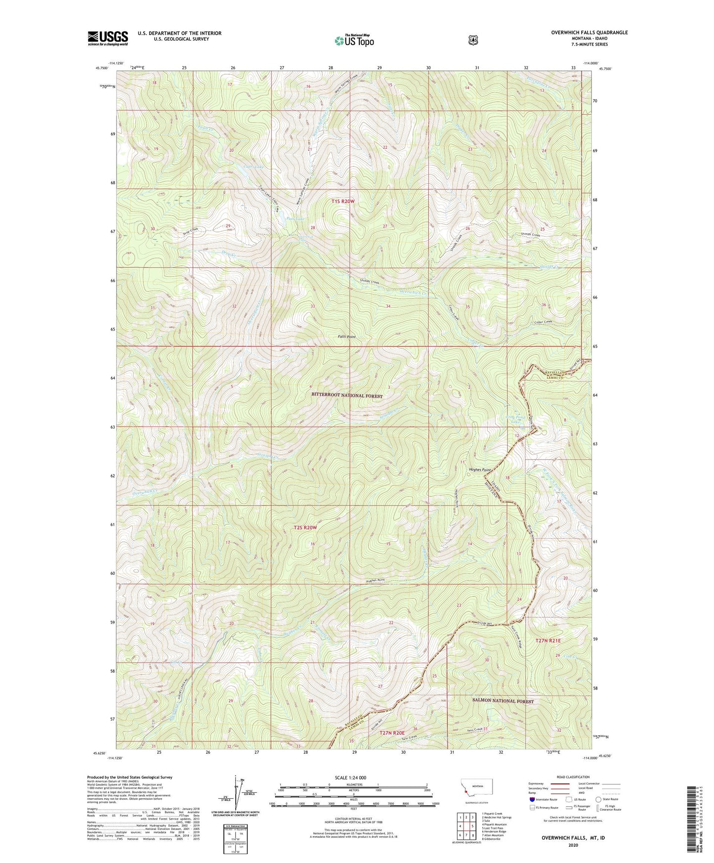
2020 topographic map quadrangle Overwhich Falls in the state of Montana. Scale: 1:24000. Based on the newly updated USGS 7.5' US Topo map series, this map is in the following counties: Ravalli, Lemhi. The map contains contour data, water features, and other items you are used to seeing on USGS maps, but also has updated roads and other features. This is the next generation of topographic maps. Printed on high-quality waterproof paper with UV fade-resistant inks.
Quads adjacent to this one:
West: Piquett Mountain
Northwest: Piquett Creek
North: Medicine Hot Springs
Northeast: Sula
East: Lost Trail Pass
Southeast: Gibbonsville
South: Allan Mountain
Southwest: Henderson Ridge
Contains the following named places: Capri Lake, Cat Creek, Colter Creek, Corner Creek, Drop Creek, Emmett Creek, Falls Point, Frog Pond Lake, Hughes Point, Lake Creek, Nicol Creek, Overwhich Falls, Pass Lake, Shields Creek, Straight Creek