MyTopo
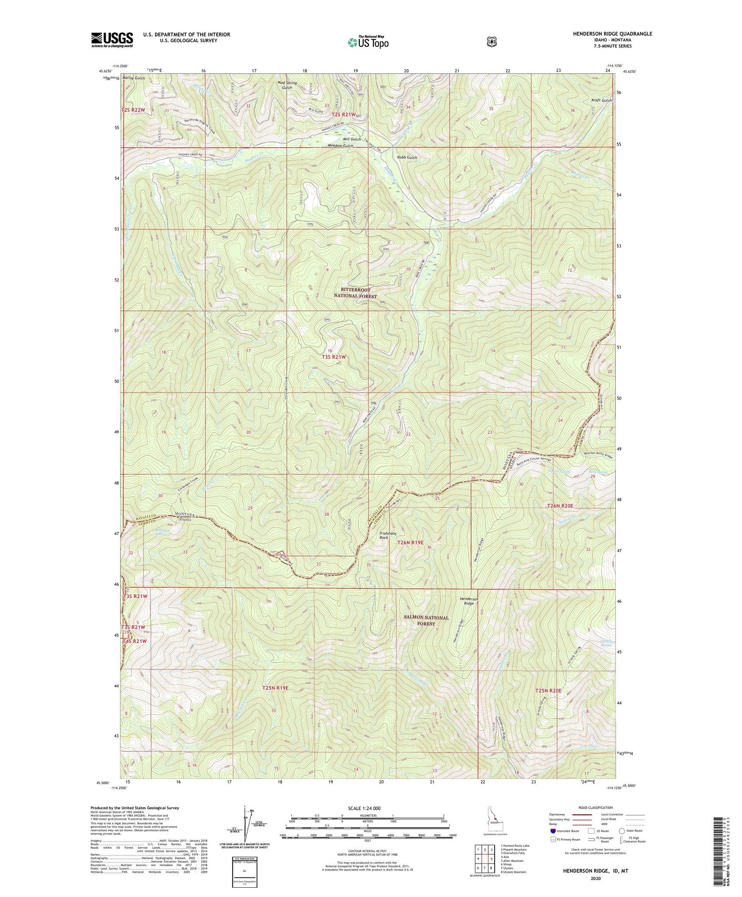
Henderson Ridge Idaho US Topo Map
Couldn't load pickup availability
Also explore the Henderson Ridge Forest Service Topo of this same quad for updated USFS data
2024 topographic map quadrangle Henderson Ridge in the states of Idaho, Montana. Scale: 1:24000. Based on the newly updated USGS 7.5' US Topo map series, this map is in the following counties: Lemhi, Ravalli. The map contains contour data, water features, and other items you are used to seeing on USGS maps, but also has updated roads and other features. This is the next generation of topographic maps. Printed on high-quality waterproof paper with UV fade-resistant inks.
Quads adjacent to this one:
West: Alta
Northwest: Painted Rocks Lake
North: Piquett Mountain
Northeast: Overwhich Falls
East: Allan Mountain
Southeast: Ulysses Mountain
South: Ulysses
Southwest: Shoup
Contains the following named places: Bare Spring, Burrell Creek, Chrandal Creek, Christmas Tree Creek, Grizzly Spring, Henderson Cabin, Henderson Ridge, Hughes Creek Placer Mine, Irishmans Rock, Kraft Gulch, McConn Creek, Meadow Gulch, Mill Gulch, Mine Creek, Muleshoe Springs, Robb Gulch, Spruce Creek, Taylor Creek, Taylor Creek Mine, Tincan Spring