MyTopo
Papoose Hills Montana US Topo Map
Couldn't load pickup availability
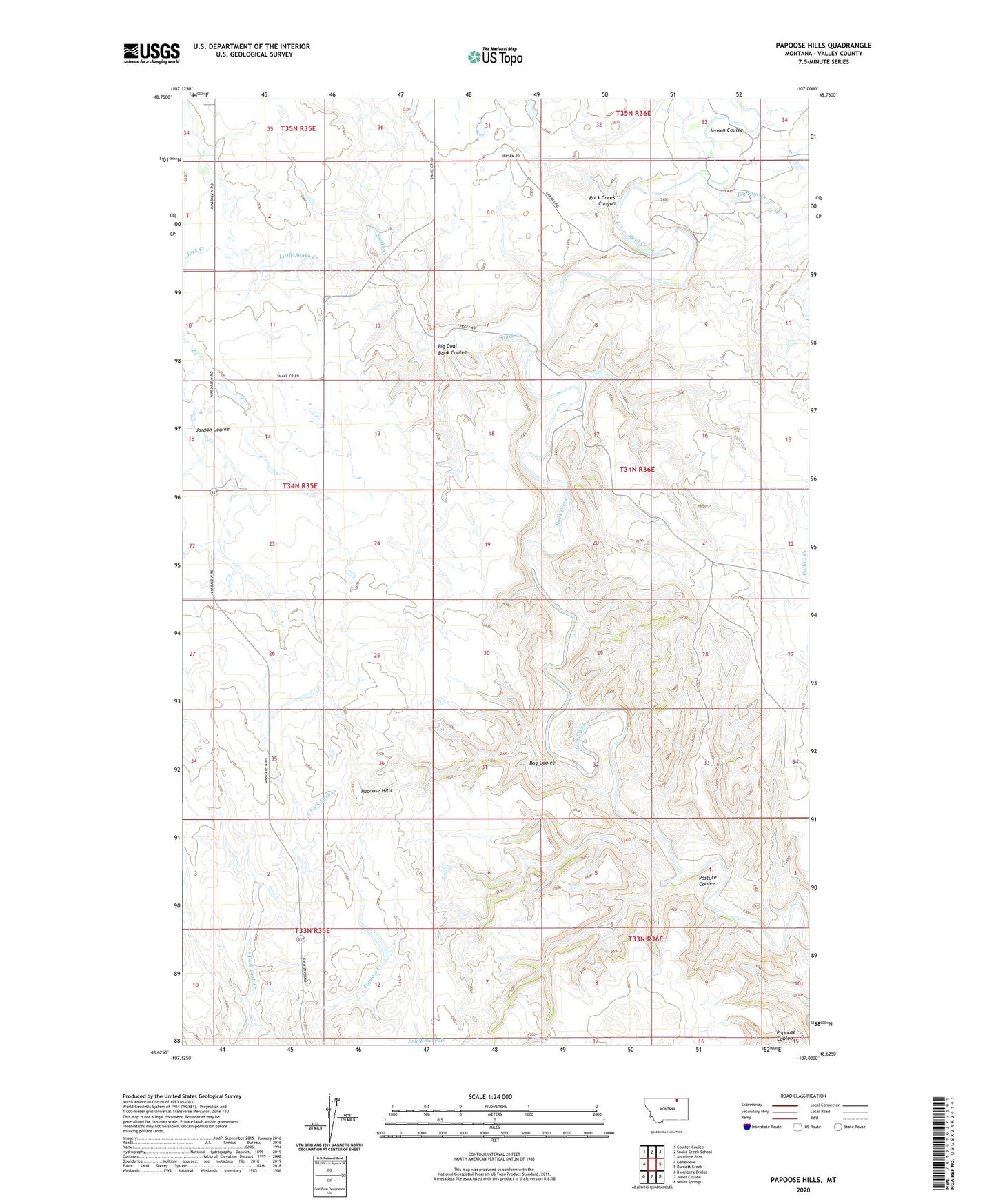
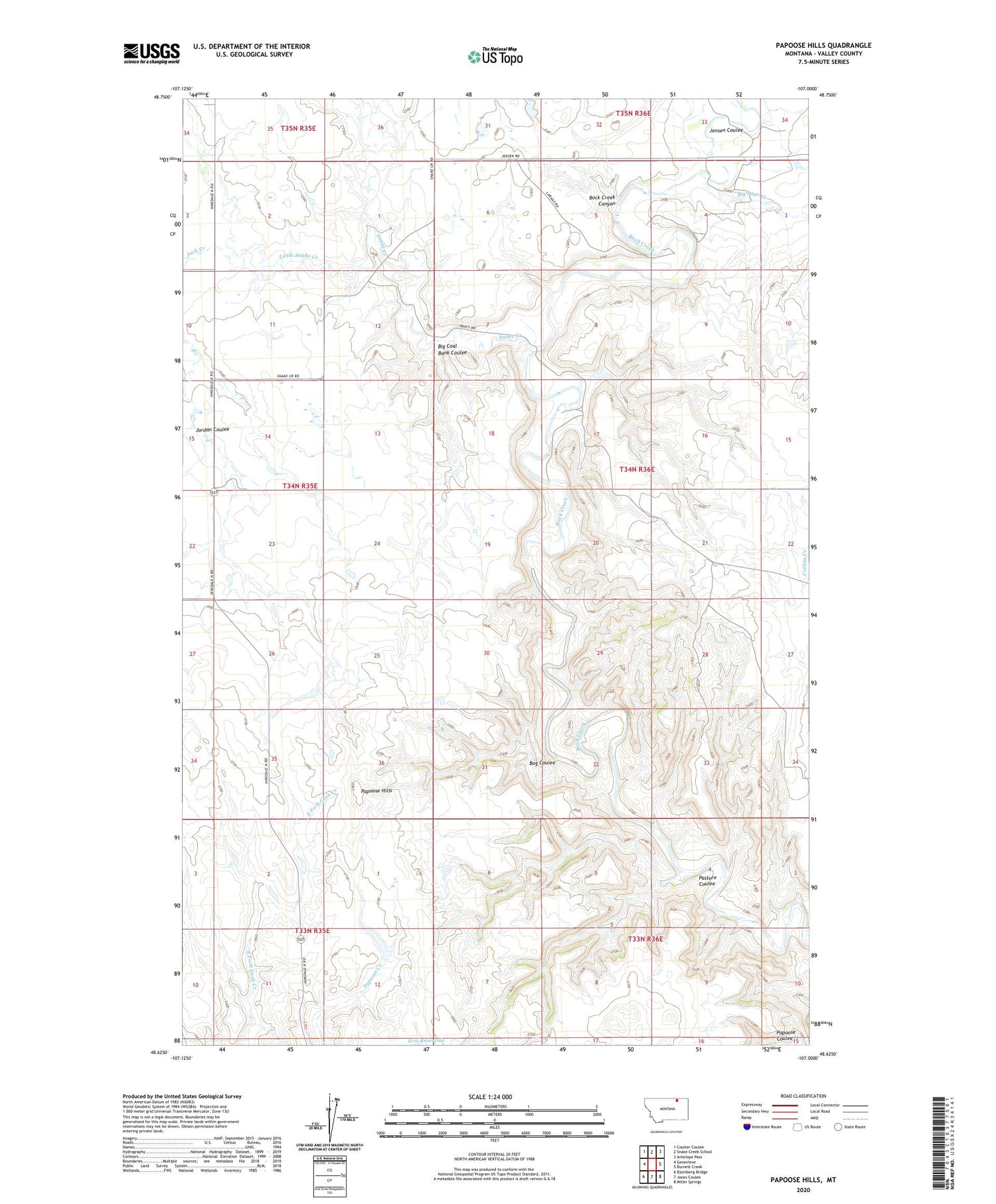
2020 topographic map quadrangle Papoose Hills in the state of Montana. Scale: 1:24000. Based on the newly updated USGS 7.5' US Topo map series, this map is in the following counties: Valley. The map contains contour data, water features, and other items you are used to seeing on USGS maps, but also has updated roads and other features. This is the next generation of topographic maps. Printed on high-quality waterproof paper with UV fade-resistant inks.
Quads adjacent to this one:
West: Genevieve
Northwest: Coulter Coulee
North: Snake Creek School
Northeast: Antelope Pass
East: Burnett Creek
Southeast: Miller Springs
South: Jones Coulee
Southwest: Bjornberg Bridge
Contains the following named places: 34N35E01AC__01 Well, 34N35E15DA__01 Well, Barr, Barr Post Office, Barr School, Big Coal Bank Coulee, Big Sage Creek, Bog Coulee, Crow Creek, Jack Creek, Jensen Coulee, Jones Dam, Jordan Coulee, Keefer Post Office, Little Snake Creek, Nelsons Dam, Papoose Hills, Pasture Coulee, Snake Creek, Tomtown