MyTopo
Bjornberg Bridge Montana US Topo Map
Couldn't load pickup availability
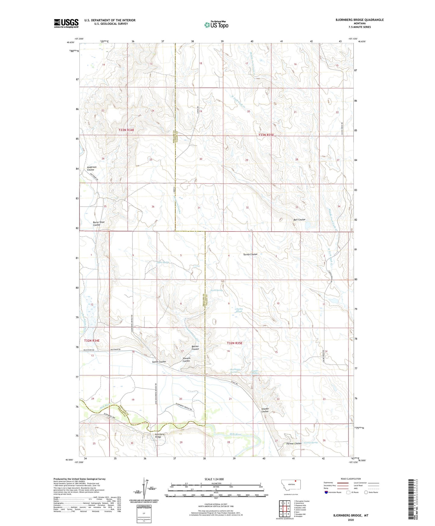
2024 topographic map quadrangle Bjornberg Bridge in the state of Montana. Scale: 1:24000. Based on the newly updated USGS 7.5' US Topo map series, this map is in the following counties: Valley, Phillips. The map contains contour data, water features, and other items you are used to seeing on USGS maps, but also has updated roads and other features. This is the next generation of topographic maps. Printed on high-quality waterproof paper with UV fade-resistant inks.
Quads adjacent to this one:
West: Double S Hill
Northwest: Porcupine Coulee
North: Genevieve
Northeast: Papoose Hills
East: Jones Coulee
Southeast: Hinsdale
South: Hinsdale NW
Southwest: Saco
This map covers the same area as the classic USGS quad with code o48107e2.
Contains the following named places: 33N35E17BCCC01 Well, Anderson Coulee, Bell Coulee, Bjornberg Bridge, Bjornberg Bridge Fishing Access Site, Bucher Coulee, Burnt Shed Coulee, Chesley Slough, East Fork Cash Creek, Farmer Coulee, Farmer Spring, Frenchman Creek School, Frenchman Irrigation Company Canal, McChesney Reservoir, McChesney Springs, Middle Fork Cash Creek, Nelson's Ranch, North Bench School, North Spring, Smith Coulee, Smoke School, Snieder Coulee, Snieder Spring, Snieder's Ranch, Stevens Coulee, Stuff School, Swanson Coulee, Taylor Spring, West Cache Creek School, West Fork Cash Creek