MyTopo
Miller Springs Montana US Topo Map
Couldn't load pickup availability
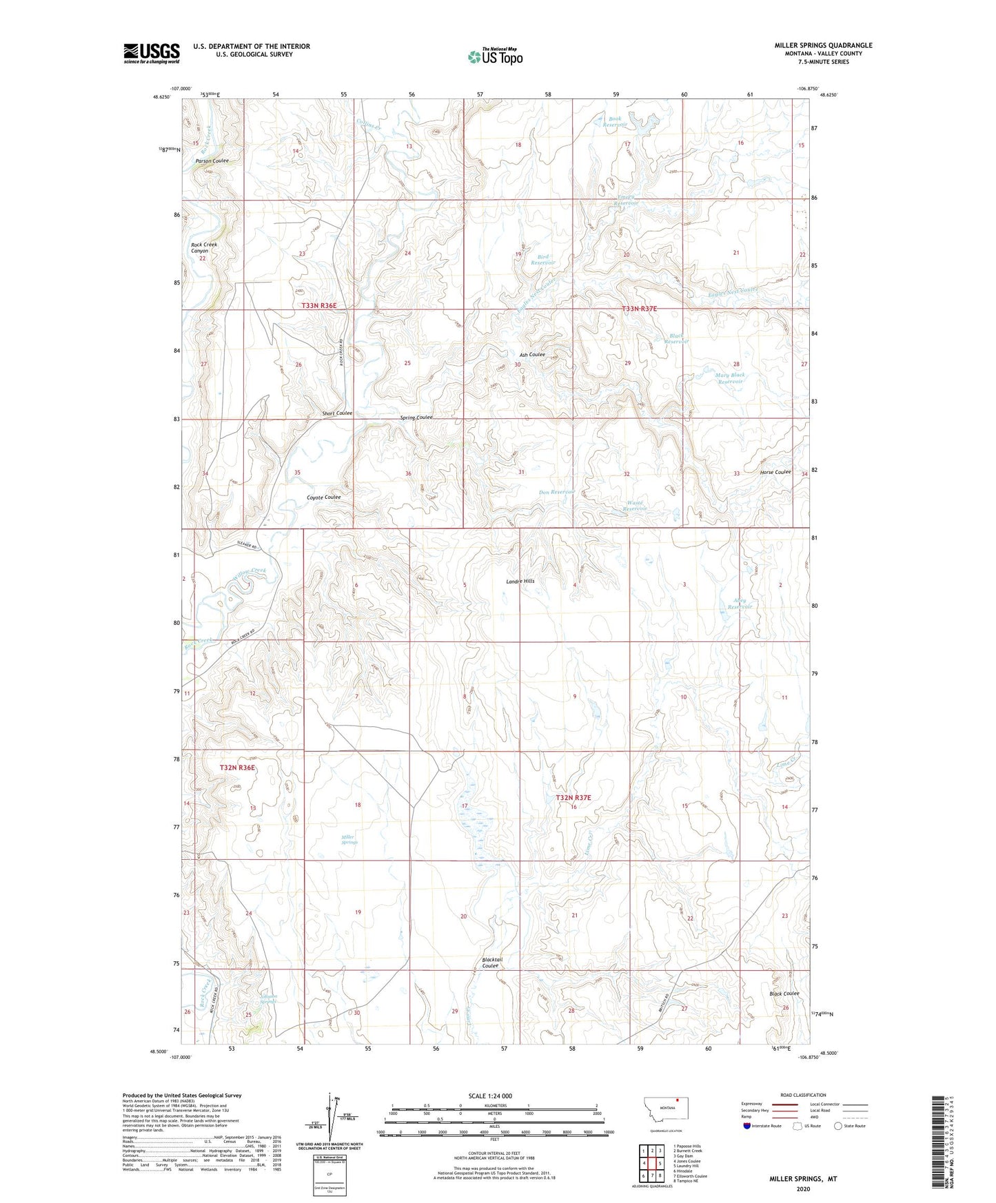
2024 topographic map quadrangle Miller Springs in the state of Montana. Scale: 1:24000. Based on the newly updated USGS 7.5' US Topo map series, this map is in the following counties: Valley. The map contains contour data, water features, and other items you are used to seeing on USGS maps, but also has updated roads and other features. This is the next generation of topographic maps. Printed on high-quality waterproof paper with UV fade-resistant inks.
Quads adjacent to this one:
West: Jones Coulee
Northwest: Papoose Hills
North: Burnett Creek
Northeast: Gay Dam
East: Laundry Hill
Southeast: Tampico NE
South: Ellsworth Coulee
Southwest: Hinsdale
This map covers the same area as the classic USGS quad with code o48106e8.
Contains the following named places: 32N37E09BB__01 Well, Abey Reservoir, Ash Coulee, Bird Reservoir, Black Reservoir, Blacktail Coulee, Book Reservoir, Collins Creek, Coyote Coulee, Don Reservoir, Eagles Nest Coulee, Emory Reservoir, Hinsdale Division, Horse Coulee, Johnson Springs, Landre Hills, Mary Black Reservoir, Miller Springs, Parson Coulee, Short Coulee, Spring Coulee, Waste Reservoir, Willow Creek