MyTopo
Pasture Creek Montana US Topo Map
Couldn't load pickup availability
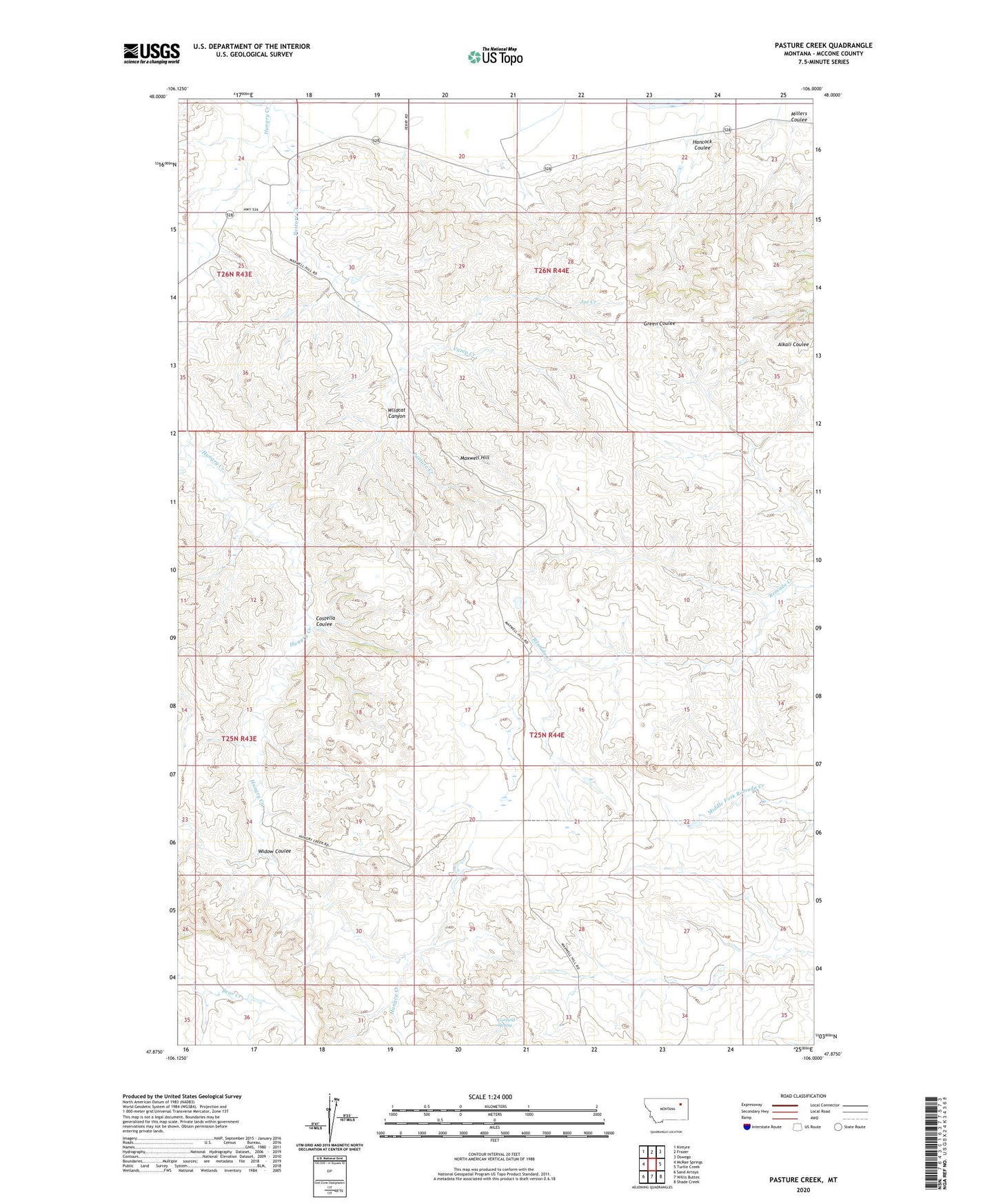
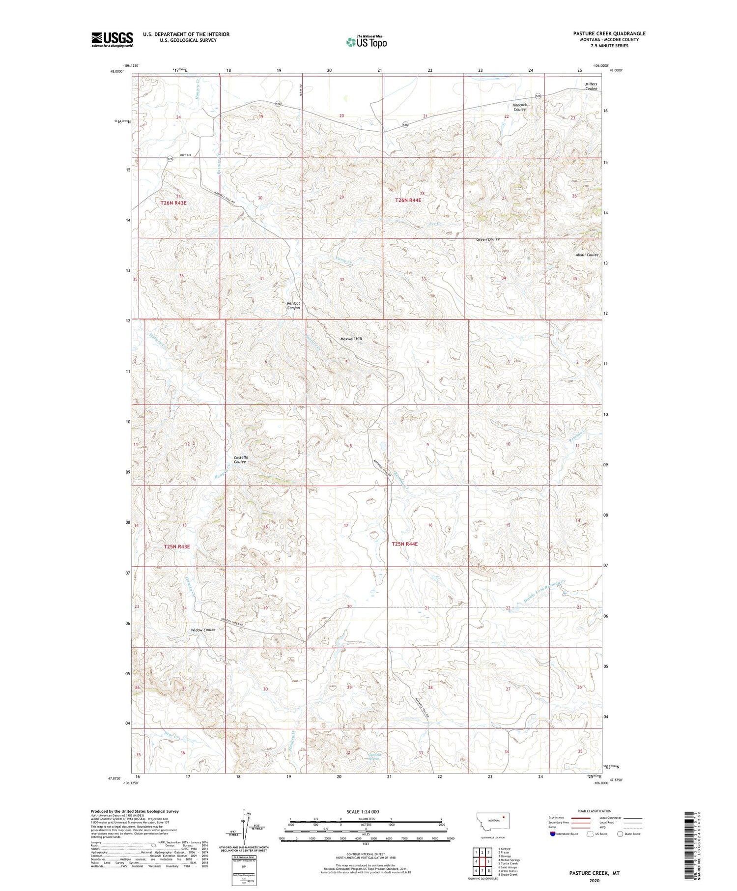
2020 topographic map quadrangle Pasture Creek in the state of Montana. Scale: 1:24000. Based on the newly updated USGS 7.5' US Topo map series, this map is in the following counties: McCone. The map contains contour data, water features, and other items you are used to seeing on USGS maps, but also has updated roads and other features. This is the next generation of topographic maps. Printed on high-quality waterproof paper with UV fade-resistant inks.
Quads adjacent to this one:
West: McRae Springs
Northwest: Kintyre
North: Frazer
Northeast: Oswego
East: Turtle Creek
Southeast: Shade Creek
South: Willis Buttes
Southwest: Sand Arroyo
Contains the following named places: 25N44E08CDDC01 Well, 25N44E27CCDD01 Well, 26N43E24DD__01 Well, 26N44E19AA__01 Well, 26N44E19AB__01 Well, 26N44E19BD__01 Well, 26N44E20AA__01 Well, 26N44E20AD__01 Well, 26N44E20AD__02 Well, 26N44E20AD__03 Well, 26N44E20BA__01 Well, 26N44E20DA__01 Well, 26N44E21AA__01 Well, 26N44E21AB__01 Well, Camp Creek, Costella Coulee, Deadman Dam, Garfield Spring, Hancock Coulee, Joe Creek, Maxwell Hill, Millers Coulee, Pasture Creek, Widow Coulee, Wildcat Canyon