MyTopo
Pea Lake Montana US Topo Map
Couldn't load pickup availability
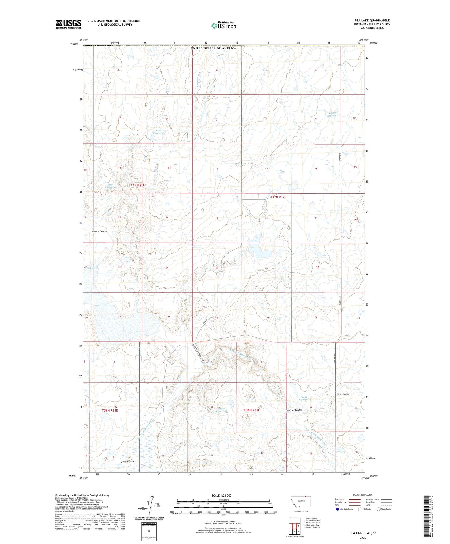
2024 topographic map quadrangle Pea Lake in the state of Montana. Scale: 1:24000. Based on the newly updated USGS 7.5' US Topo map series, this map is in the following counties: Phillips. The map contains contour data, water features, and other items you are used to seeing on USGS maps, but also has updated roads and other features. This is the next generation of topographic maps. Printed on high-quality waterproof paper with UV fade-resistant inks.
Quads adjacent to this one:
West: Gustin Coulee
East: Thoeny Hills West
Southeast: Salsbery Reservoir
South: Whitewater East
Southwest: Whitewater West
This map covers the same area as the classic USGS quad with code o48107h5.
Contains the following named places: 37N32E19AAA_01 Well, Artie Reservoir, Corwine Center Post Office, Dunham Coulee, Ethel Reservoir, Gustin Coulee, Haukos Coulee, Haukos School, Lester Reservoir, Nerve Reservoir, Pea Lake, Plainsview School, PR-156 Dam, PR-88 Dam, Sarm Reservoir, Voje Coulee