MyTopo
Penzer School Montana US Topo Map
Couldn't load pickup availability
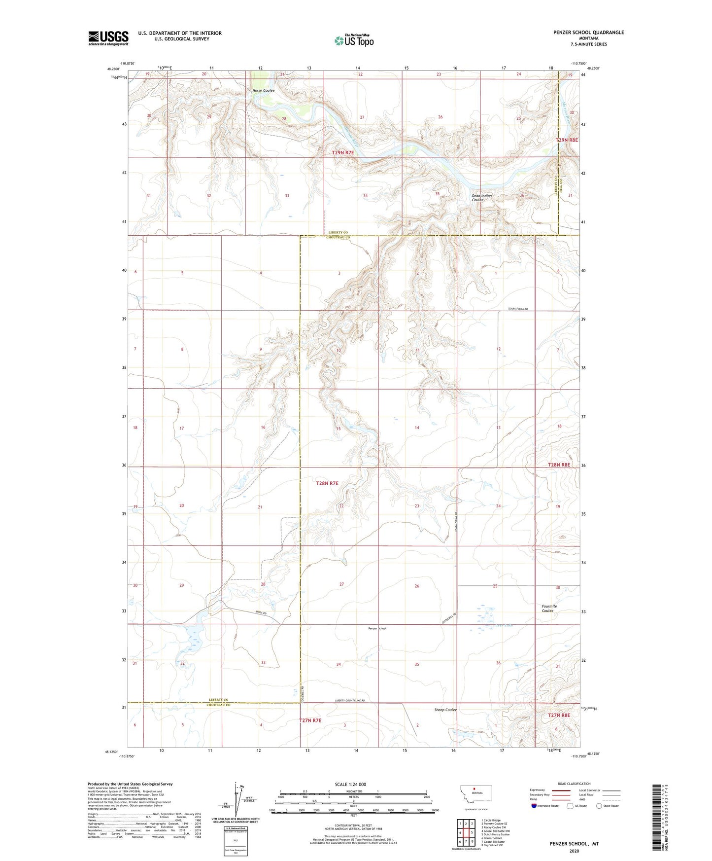
2024 topographic map quadrangle Penzer School in the state of Montana. Scale: 1:24000. Based on the newly updated USGS 7.5' US Topo map series, this map is in the following counties: Liberty, Chouteau, Hill. The map contains contour data, water features, and other items you are used to seeing on USGS maps, but also has updated roads and other features. This is the next generation of topographic maps. Printed on high-quality waterproof paper with UV fade-resistant inks.
Quads adjacent to this one:
West: Goose Bill Butte NW
Northwest: Circle Bridge
North: Poverty Coulee SE
Northeast: Rocky Coulee SW
East: Dutch Henry Coulee
Southeast: Day School SW
South: Goose Bill Butte
Southwest: Dorner School
This map covers the same area as the classic USGS quad with code o48110b7.
Contains the following named places: Dead Indian Coulee, Goose Bill Post Office, Horse Coulee, Lees Lake, Night Fever School Dam, Penzer Dam, Penzer School, Romain Dam, Romain Reservoir, Squiggles Number 2 Dam