MyTopo
Poverty Coulee SE Montana US Topo Map
Couldn't load pickup availability
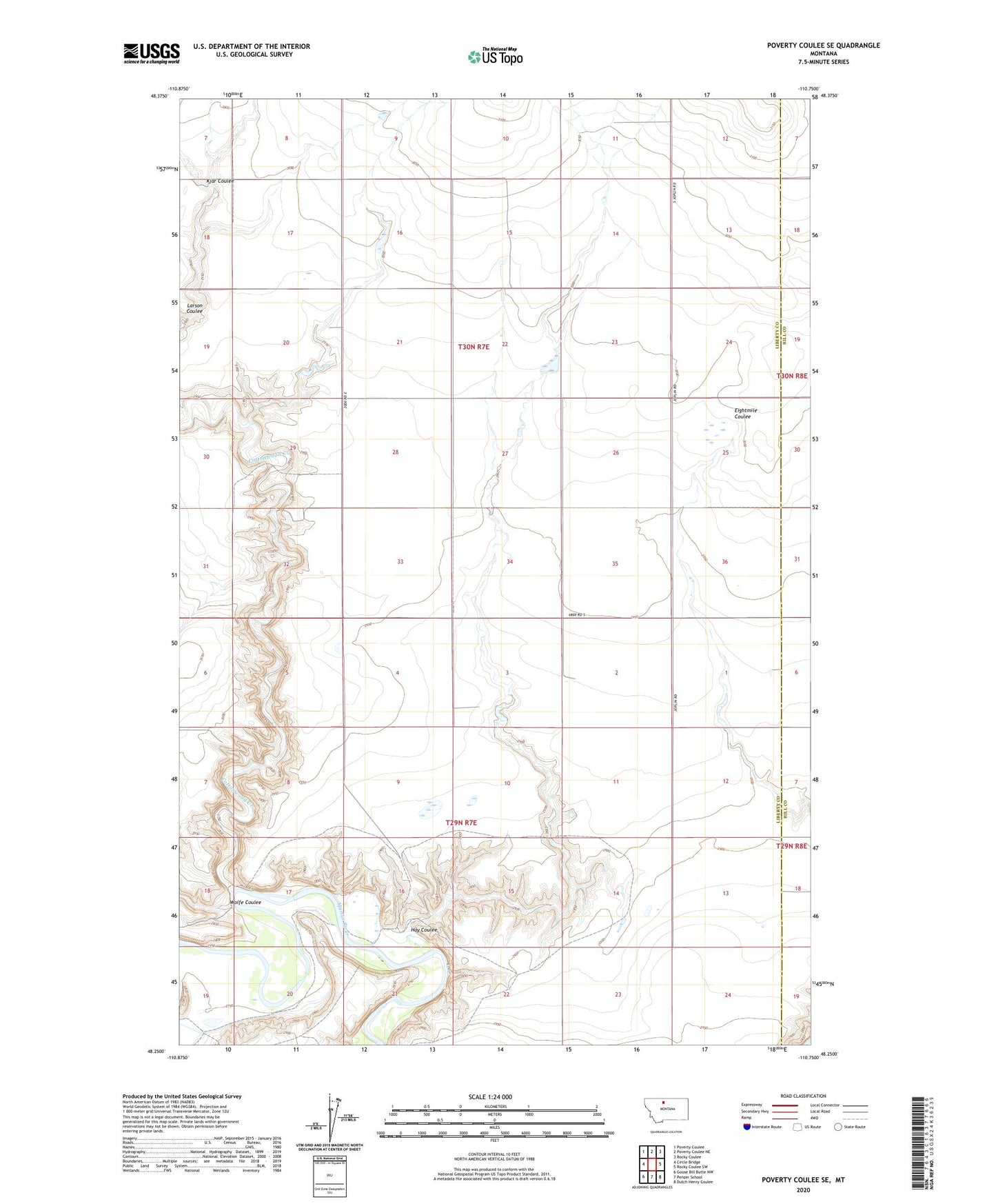
2024 topographic map quadrangle Poverty Coulee SE in the state of Montana. Scale: 1:24000. Based on the newly updated USGS 7.5' US Topo map series, this map is in the following counties: Liberty, Hill. The map contains contour data, water features, and other items you are used to seeing on USGS maps, but also has updated roads and other features. This is the next generation of topographic maps. Printed on high-quality waterproof paper with UV fade-resistant inks.
Quads adjacent to this one:
West: Circle Bridge
Northwest: Poverty Coulee
North: Poverty Coulee NE
Northeast: Rocky Coulee
East: Rocky Coulee SW
Southeast: Dutch Henry Coulee
South: Penzer School
Southwest: Goose Bill Butte NW
This map covers the same area as the classic USGS quad with code o48110c7.
Contains the following named places: 29N07E01DA__01 Well, 29N07E02CB__01 Well, 29N07E02CBBD01 Well, 29N07E03CD__01 Well, 29N07E11AD__01 Well, 29N07E12AB__01 Well, 29N08E06BB__01 Well, 30N07E34DC__01 Well, 30N08E31CC__01 Well, Cottonwood Creek, Hay Coulee, Hay Coulee Post Office, Hay Coulee School, Kjar Coulee, Nahrgang Dam, Warsaw Post Office, Wolfe Coulee