MyTopo
Piche Montana US Topo Map
Couldn't load pickup availability
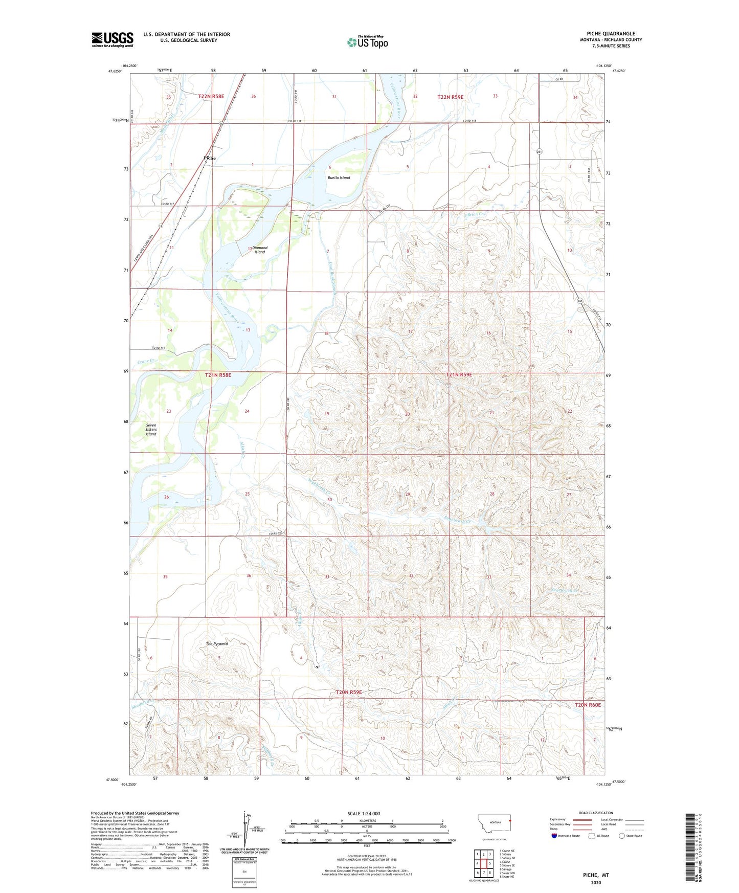
2020 topographic map quadrangle Piche in the state of Montana. Scale: 1:24000. Based on the newly updated USGS 7.5' US Topo map series, this map is in the following counties: Richland. The map contains contour data, water features, and other items you are used to seeing on USGS maps, but also has updated roads and other features. This is the next generation of topographic maps. Printed on high-quality waterproof paper with UV fade-resistant inks.
Quads adjacent to this one:
West: Crane
Northwest: Crane NE
North: Sidney
Northeast: Sidney NE
East: Sidney SE
Southeast: Skaar NE
South: Skaar NW
Southwest: Savage
Contains the following named places: 20N59E03DBA_01 Well, 20N59E04DDDB01 Well, 20N59E08BC__01 Well, 20N59E11BDC_01 Well, 21N58E01AA__01 Well, 21N58E02AD__01 Well, 21N58E02DD__01 Well, 21N58E11BB__01 Well, 21N58E11BD__01 Well, 21N58E11DC__01 Well, 21N58E14BB__01 Well, 21N58E14DB__01 Well, 21N59E03CC__01 Well, 21N59E08AA__01 Well, 21N59E08BB__01 Well, 21N59E08BCD_01 Well, 21N59E08DB__01 Well, 21N59E15DDBA01 Well, 21N59E18CD__01 Well, 21N59E20AAAC01 Well, 21N59E22DDC_01 Well, 21N59E30BBCA01 Well, 21N59E33DBBB01 Well, 22N58E36DD__01 Well, 22N58E36DDD_01 Well, 22N59E31CB__01 Well, 22N59E31CC__01 Well, 22N59E31DD__01 Well, 22N59E32CD__01 Well, 22N59E32DA__01 Well, 22N59E32DD__01 Well, 22N59E34CA__01 Well, 22N59E34CB__01 Well, 59217, Alkali Creek, Buella Island, Coal Bank Slough, Crane Creek, Diamond Island, Hastetter Number 1 Dam, Hastetter Number 2 Dam, Main Canal, O'Brien Creek, Piche, Sagebrush Creek, Seven Sisters Fishing Access Site, Seven Sisters Island, The Pyramid